Saturday,
10/27/2018, Mt Glasgow North – Hwy66, Elbow River Valley, Kananaskis, AB
· Round Trip: 15.5km;
Elevation: 2487m; Elevation Gain: 881m; Time:
RT - 7:20hrs (10:00-17:20), ascent- 3:35hrs, descent - 2:45hrs, could moved
fast with less powerful wind; easy scramble
· Book: ‘Gillean
Daffern’s Kananaskis Country Trail Guide—Volume 2’ by Gillean Daffern
References:
· Mount
Glasgow - 2935 m
(9,630ft); 50.7556N -114.932W; Located between the Little Elbow River Valley
and the Elbow River Valley; Province: Alberta; Park: Kananaskis; Headwater:
Bow; Major Valley: Elbow; Visible from Highway: 66. Ascent Date: 1949; Ascent
Party: Arnold Choquette. Year Named: 1922; Named for: HMS Glasgow was a battle
cruiser which fought in the Battle of the Falkland Islands during WW I.
(from peakfinder.com)
Drive
From Calgary, drive west on Hwy 1, take the exit
for Bragg Creek driving south on Hwy 22 for 21.1 km, turn right heading west on
Hwy 66 for 27.5 km to an intersection just before the gravelly Powderface
Trail, turn left into Little Elbow Recreation Area, drive to the end and park
in the Trailhead Parking lot to the left of the road. Driving time would be
around 0:55 hours.
Hike
Mt Glasgow North, as the name suggests, is
the northmost peak in the Glasgow massif. The route along its northeast ridge has
a reasonable trail in the trees, and is a nice ridge walk above treeline with a
couple easy and interesting downclimbs before the gentle scree slope leading to
the summit.
From trailhead, we
walked southwest for about 600 meters, crossed the suspension bridge over
Little Elbow River, and then immediately turned right onto a single trail that
connects to the Little Elbow equestrian trail which led us to the base of the
northeast ridge of Glasgow North. There were couple ribbons indicating the
route up a hard dirt slope and a small cairn on the top showed the entrance to
the forested ridge. With reasonable trails here and there, the bushwhacking
through the trees was minimal. The trail became undefined at about 2000m where
we encountered snow patches. The snow was just boot deep and the route up was
so obvious, so we made it to treeline without any trouble. However, once out
of the trees, nothing but the wind became the only obstacle of our ascent along
the ridge crest since I was blown down a couple times when it was gusting fiercely.
Fortunately, it was incredibly calm when we needed it to be to finish the
narrow and scramble parts of the ridge. The last downclimb well before the
gentle slope connects to the summit was a bit tricky due to the icy snow. When
dry, it would be very easy to scramble down directly or get off via a ledge to
the right. After that, we soon stood on the summit of Mt Glasgow North against
the strong wind.
The wind wasn’t as
strong as before but still strong enough to force us hiding behind a big rock most
of the time and, moreover, dropping the idea of going further to Peak 46125 to
southwest. But we still endured the wind for one hour taking in the view before
retracing our steps back to the car.
On the descent, if
not because of the small incident of uncontrolled glissading happened on Gua,
it was otherwise a rather tame hike back to the car.
My track

Starting off

Mt Glasgow North and Peak 46125 from the suspension bridge
On the Little Elbow equestrian trail after crossing the suspension bridge
Mt Remus(CL) and Fisher Peak(R) on the way up

Nihahi Ridge on the way up

The ribbons show the way into the woods

Leave the trail and walk left to the base of the northeast ridge of Glasgow North with the help of couple ribbons

Going up the small rib

Looking back down

The initial forested ridge

With reasonable trails here and there, the bushwhacking through the trees was minimal

Mt Fullerton on left

The trail became undefined at about 2000m where we encountered snow patches

Once out of the trees, nothing but the wind became the only obstacle of our ascent

Climbing up to the ridge crest

Great view towards Nihahi Ridge

l-r: Mt Romulus, Mt Remus, and Fisher Peak to the northwest

Being blown down by a gust of wind

Advancing against the wind

l-r: Mt Romulus, Mt Remus, Fisher Peak(B), and Mt Fullerton

There is a gap in the connecting ridge leading to Peak 46125(CR)

Negotiating a downclimb covering thin snow

Looking up the easy but icy downclimb

The ridge narrows a bit after the downclimb

Looking back

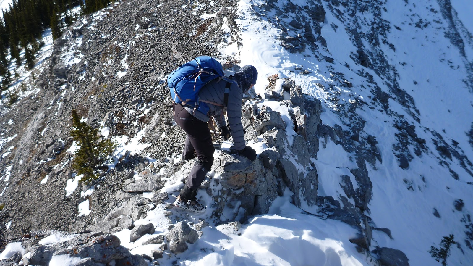
Being cautious on the slightly exposed section

The last downclimb well before the gentle slope connects to the summit was a bit tricky due to the icy snow

When dry, it would be very easy to scramble down directly or get off via a ledge to the right

Fortunately, it was incredibly calm at the moment

Looking back

Going up the last gentle slope

Standing on the summit of Mt Glasgow North against the strong wind

View east towards Forgetmenot Mtn

View south-southeast with Threepoint Mtn, Mt Rose and Bluerock Mtn(C) poking out from behind

A closeup of (l-r) Mounts Blane, Brock, and Hood to the southwest

In the background,Mounts Hood, Evan-Thomas, Potts, and Denny beyond Evan-Thomas East(CL) and the outlier of Mt Romulus(C/CR) to the west-southwest

Mt Romulus(C) and Mt Remus(R) to the west-northwest in the front

The city of Calgary on the horizon to the northeast

Mt Romulus(L),Mt Remus(CL,F), Fisher Peak(CL,B), and Mt Fullerton(R) across the flat summit of Mt Glasgow North to the northwest

Looking north-northwest to Mt Fullerton(L) and Nihahi Ridge(R) with Nihahi Creek lies between them

Looking north-northeast to Nihahi Creek and Ridge with Moose(CR,B) and Prairie(R of Moose,B) Mountains beyond

The true Summit of Mt Glasgow(CR) and Peak 46125(R) to the south

Zooming in on (l-r) Mounts Blane, Brock, and Hood again

Mt Romulus

Fisher Peak towering above Mt Remus to the northwest

Mt Fullerton to the NW

A close shot of Nihahi Ridge

With imagination, one can see the Fire Lookout on the top of Moose Mtn(R,B)

Prairie Mtn in the background right

A pano from the summit of Mt Glasgow North

Panorama from southwest/left to northeast/right

Time to leave

A tricky downclimb on ascent became a much easier upclimb on descent

More ups and downs ahead

Easy scramble up

Hiking back up the ridge after an uncontrolled glissading

Hiking down the last bit of the ridge

Back on the Little Elbow equestrian trail

The suspension bridge in the evening sunlight

Hiking Little Elbow trail back to the car

The end.

Starting off

Mt Glasgow North and Peak 46125 from the suspension bridge

On the Little Elbow equestrian trail after crossing the suspension bridge

Mt Remus(CL) and Fisher Peak(R) on the way up

Nihahi Ridge on the way up

The ribbons show the way into the woods

Leave the trail and walk left to the base of the northeast ridge of Glasgow North with the help of couple ribbons

Going up the small rib

Looking back down

The initial forested ridge

With reasonable trails here and there, the bushwhacking through the trees was minimal

Mt Fullerton on left

The trail became undefined at about 2000m where we encountered snow patches

Once out of the trees, nothing but the wind became the only obstacle of our ascent

Climbing up to the ridge crest

Great view towards Nihahi Ridge

l-r: Mt Romulus, Mt Remus, and Fisher Peak to the northwest

Being blown down by a gust of wind

Advancing against the wind

l-r: Mt Romulus, Mt Remus, Fisher Peak(B), and Mt Fullerton

There is a gap in the connecting ridge leading to Peak 46125(CR)

Negotiating a downclimb covering thin snow

Looking up the easy but icy downclimb

The ridge narrows a bit after the downclimb

Looking back

Being cautious on the slightly exposed section

The last downclimb well before the gentle slope connects to the summit was a bit tricky due to the icy snow
When dry, it would be very easy to scramble down directly or get off via a ledge to the right

Fortunately, it was incredibly calm at the moment

Looking back

Going up the last gentle slope

Standing on the summit of Mt Glasgow North against the strong wind

View east towards Forgetmenot Mtn

View south-southeast with Threepoint Mtn, Mt Rose and Bluerock Mtn(C) poking out from behind

A closeup of (l-r) Mounts Blane, Brock, and Hood to the southwest

In the background,Mounts Hood, Evan-Thomas, Potts, and Denny beyond Evan-Thomas East(CL) and the outlier of Mt Romulus(C/CR) to the west-southwest

Mt Romulus(C) and Mt Remus(R) to the west-northwest in the front

The city of Calgary on the horizon to the northeast

Mt Romulus(L),Mt Remus(CL,F), Fisher Peak(CL,B), and Mt Fullerton(R) across the flat summit of Mt Glasgow North to the northwest

Looking north-northwest to Mt Fullerton(L) and Nihahi Ridge(R) with Nihahi Creek lies between them

Looking north-northeast to Nihahi Creek and Ridge with Moose(CR,B) and Prairie(R of Moose,B) Mountains beyond

The true Summit of Mt Glasgow(CR) and Peak 46125(R) to the south

Zooming in on (l-r) Mounts Blane, Brock, and Hood again

Mt Romulus

Fisher Peak towering above Mt Remus to the northwest

Mt Fullerton to the NW

A close shot of Nihahi Ridge

With imagination, one can see the Fire Lookout on the top of Moose Mtn(R,B)

Prairie Mtn in the background right

A pano from the summit of Mt Glasgow North

Panorama from southwest/left to northeast/right

Time to leave

A tricky downclimb on ascent became a much easier upclimb on descent

More ups and downs ahead

Easy scramble up


Hiking back up the ridge after an uncontrolled glissading

Hiking down the last bit of the ridge

Back on the Little Elbow equestrian trail

The suspension bridge in the evening sunlight

Hiking Little Elbow trail back to the car

The end.
No comments:
Post a Comment