Sunday,
4/21/2019, Read’s Tower II – Smith-Dorrien/Hwy742, B.V.W. PP, Kananaskis, AB
· Round Trip: 6.5km;
Elevation: 2665m; Elevation Gain: 921m; RT Time: 5:10 hrs (11:40-16:50), ascent
– 2:40hrs, descent – 1:50hrs; Easy scramble/difficult snowshoeing or hiking
with steep slopes
· Books: ‘Snowshoeing
in the Canadian Rockies’ by Andrew Nugara
‘Gillean
Daffern’s Kananaskis Country Trail Guide—Volume 1’ by Gillean Daffern
Drive
From Calgary, drive west on Hwy 1 for about 88km
and take the #89 exit for Canmore. Turn right at STOP Sign and YIELD sign
separately, cross Hwy 1 on Benchlands Trail, then drive on Railway Avenue until
8 Street, turn left here onto 8 Street. Keep driving west until a four way stop
intersection, and turn left onto 8 Avenue for about 240meters, turn right onto
Bridge Rd. After crossing Bow River on a bridge, turn left at a T Junction,
then turn right onto Smith-Dorrien Trail / Hwy 742 for about 24.6 km to
Sparrowhawk parking lot, park on either side of the road. Driving time would be
around 1:45 hour.
Hike
Not knowing where to go but being ashamed
of wasting a sunny day, we started to think of repeating a peak, which is very
rare for us, that is essentially surrounded by gorgeous scenes that were
totally absent at the time we summited it. Read’s Tower would perfectly fit in
this category since we were facing whiteout weather on our snowshoeing ascent
back in 2016, so we chose it as our second target for the last day of this long
weekend.
When we arrived at
the parking spot, there was another car at the trailhead. We caught them up at
the bottom of the first steep slope below Read’s Ridge, and found out that one
of the two ladies in their 4-people group dressed very casual and was carrying a
handbag and a plastic bag like doing grocery shopping. I thought the steep and
icy slope they were struggling with might deter them from continuing up, but I
was wrong. They showed up on the ridge crest while we were ascending the final
slope to Read’s Tower. This lady’s perseverance was unbelievable, and she finally
received some beautiful mountain scenery as a reward that she richly deserved.
Unlike last time wearing
snowshoes and crampons, we wore boots up to Read’s Ridge and then put on our
microspikes for the last snowy slope leading to the summit of Read’s Tower. At
some points, I really regretted leaving my crampons in the car. It didn’t mean
they were a must, but I would be much confident if I was wearing them on those
steep section covered by hard snow. Fortunately, this kind of terrain was
avoided by sticking on the wind-blown ridge crest to the left.
By the time we
started our descent, the snow softened a lot and some of the fresh snow was
melting away. We quickly backtracked down to the ridge, and then hiked back to
the trailhead where we caught up that 4-people group again.

When we arrived at the parking spot, there was another car at the trailhead

Icy trail in the trees

The first steep slope below Read’s Ridge

Cresting Read's Ridge with Mt Sparrowhawk(CL) and Read's Tower(CR) ahead

Hiking along Read's Ridge with Mt Sparrowhawk at far left and Read's Tower ahead

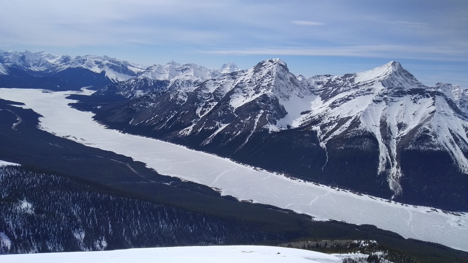
A Pano from south/left to northwest/right with Mt Nestor(CL) and Goat Mtn(CR) overlooking Spray Lakes to the west

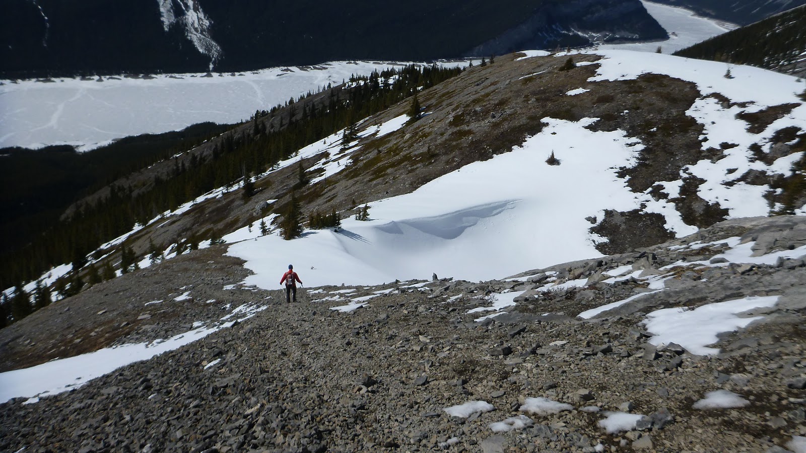
The slope leading to the summit of Read's Tower starts with a steep scree slope

Traversing to the lower angle but snow-covered slope after taking enough scree

l-r: Red Peak,Mt Galatea, The Tower(CL,B), Mt Engadine(CR,B), and Buller Mtn rise above Red Ridge to the south

Encountering some hard snow here

The last bit to the summit

Standing on the summit of Read's Tower with Mt Sparrowhawk in the b/g left

Mt Bogart to the SE

Red Ridge and Red Peak to the south in the foreground and Mid ground with (l-r) The Fortress, Mt Galatea(CL), The Tower(CR), and Mt Engadine(R) beyond

View SW with Mt Smuts(L) and Mt Shark(R) in the b/g

Eon Mtn(L) and Mt Assiniboine(R) towering above Cone Mtn (CL)to the SW

Big(CL) and Middle(CR) Sisters to the NW

A panorama from S/L to NW/R from the top of Read's Tower

Mt Bogart again and the basin below her

View South again

Admiring views along the Spray Lakes

View W-SW
View NW

Basically sticking on the wind-blown ridge crest to skier's right on our descent

Looking back up towards the summit

Can't have enough views along the long lake

Not a good scree run
Below the shear rock face is the route to Mt Sparrowhawk

Looking NW along the ridge

Back to the trailhead where we caught up that 4-people group again

The end.
No comments:
Post a Comment