TRIP 322
Saturday,
4/20/2019, Muleshoe Ridge – Rockbound Lake TH, Castle Junction, Hwy1A, Banff
NP, AB
· Round Trip: 6km;
Elevation: 2280m; Elevation Gain: 855m; Time: RT – 6:25hrs (09:55-16:20),
ascent – 2:50hrs, descent – 1:20hrs; Easy scramble or steep hike with thick
deadfall before summit
· Book:
Drive
From Calgary, drive west on Hwy 1 for about 117
km, take the exit for Johnston Canyon/Bow Valley Pkwy (Hwy 1A), driving west on
Hwy 1A for about 5.2 km and then turn left into Muleshoe parking lot. Driving time would be around
1:30 hours.
Hike
It has been 9 days since we came back from a 3-week trip to
Guangzhou visiting our families there, but we still had a little jet lag and
were not confident of doing a big hike yet. Besides, the recent snowfall in the
alpine area hindered us from choosing a big object. So we considered Muleshoe
Ridge – an outlier west of Mt Cory being less than 2300 metres high – would be
a good exercise for us to resume our normal mountain life.
Our journey started by hiking an obvious
trail across the Hwy 1A into the morning mist that gave us an air of mystery.
We then soon found us ascending a steep slope guarded by three deer. We waited
for a while and then kept walking up while they moved a little bit further from
the trail and busied themselves in chewing grasses. After this steep slope, the
trail levels and was dusted with fresh snow until another steep slope leading
to the summit. The slope is steep initially but still just a steep hike. While
the grade of slope eases off a bit, we started to encounter the notorious deadfall.
Actually, it wasn’t too bad, and all we needed to do was just patiently
detouring around, walking on, and / or ducking under those fallen trees. The
biggest challenge, however, would be the unsupported deep snow between the forested
summit and the semi-open view point to the west. At first, we couldn’t see any
open area at all and were wrapped up in trees and knee-deep snow. After
swimming in the snow along the ridge and slightly went down to the west, we
finally arrived on the view point and the landscape to the west unfolded before
us.
After a lengthy food and photo break, we
wandered around to get a better view of Mt Cory before retracing our steps
back. I don’t know why, but the deadfall seemed much easier now, so we made a
good time on our descent and soon went back to our car.
This half-day hike wasn’t very attractive,
but well suits our warm-up need.

Besides the outhouse, there was and faint trail leading to Hwy 1A

An obvious trail across Hwy 1A brought us into the morning mist

An abandoned signpost

First glance of Muleshoe Ridge

An air of mystery around us

Ascending a steep slope guarded by three deer

Busying themselves in chewing grasses while keeping an eye out for us

Looking down at this steep slope

Changing scenery across the Bow Valley

Looking at the treed ridge leading to the summit and Mt Cory(R) when the trail levels and was dusted with fresh snow

A long train passing by below

Looking back at the semi-open ridge

Another steep slope leading to the summit

Encountering the notorious deadfall

Detouring around

Walking on fallen trees

Ducking under a couple of dead logs

A bit scramble fun here

Going up from the left side

The unexciting summit of Muleshoe Ridge

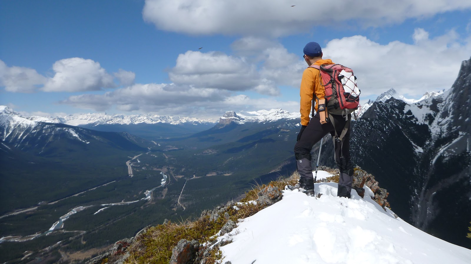
The much more attractive view point down a little bit to the west
Nasswald peak in the left centre to the south by east

Mt Howard Douglas(CL) and Eagle Mtn(CR) forming the backdrop to the south by west

Mt Bourgeau to the southwest

Black Brett(L, a sub-peak of Mt Brett) and Mt Brett(R) to the southwest

Mt Pilot towers over Massive Mtn to the west

Copper Mtn to the west by north with Storm Mtn beyond

l-r: Boom Mtn, Chickadee Peak(CL), Mt Allan(CR), Deltaform Mtn, Quadra Mtn, Bident Mtn, Mt Bell, and Hungabee Mtn(b/g R) are recognizable to the NW

l-r: Castle Mountain, Stuart Knob(C), Protection Mountain(CR,B), and Helena Ridge to the north by west

Mt Ishbel in the b/g to the north by west

A panorama (SE/L to N/R) from the semi-open viewpoint

Soaking in the view

The pointy peak at centre left is The Finger. Mt Fifi is just out of the frame to the right

The winding Bow River below

l-r: Black Brett, Mt Brett(CL), Pilot Mtn(CR), and Copper Mtn

Zooming in on Pulsatilla Mountain and Mount Avens

Looking west-northwest across Bow Valley to a sea of peaks

Wandering around in deep snow to get a better view of Mt Cory

Mt Cory

Retracing our steps back

The deadfall was much easier than it looked on descent

Mountain view on the way down

The 2nd grouse of the day

More views on descent

Tall and straight aspens near trailhead

Found a hitchhiker

The end.
No comments:
Post a Comment