Sunday,
11/25/2018, Nameless/Eagle Ridge – Hwy40, Highwood Area, Kananaskis, AB
· Round Trip: 7km
(Loop); Elevation: 2505m; Elevation Gain: 650m; Time: RT – 5:10hrs (9:40-14:50),
ascent – 1:45hrs, descent – 1:55hrs; short
hike up via Nameless Col, steep hike down on southwest slope
· Books: ‘Gillean Daffern’s
Kananaskis Country Trail Guide 4th Edition — Volume 5’ by Gillean Daffern
References:
· 50.5436N -114.880W, Located immediately
northwest of the junction of Storm Creek and Mist Creek at the headwaters of
the Highwood River, Province: Alberta, Park: Kananaskis, Headwater: Bow,
Visible from Highway: 40S. (from peakfinder.com)
Drive
From Calgary, drive west on Hwy 1 for about
60km and take exit 118, then head south on Hwy 40 for about 80.8km (7.8 km
south of Mount Lipsett day-use area, 3.6 km north of Mist Creek day-use area),
park in a lay-by on the left/north side of the road. Driving time would be
around 1:40 hours.
Hike
It was the last weekend/chance to hike
around Highwood Area this season before Hwy 40 (between PLPP and Highwood House
Junction) closes on December 1st. We chose Nameless Ridge for its
short distance to fit a typical November day that has insufficient daylight hours to commit
a bigger object. Since the snow kept falling until early Saturday morning, we figured
that Sunday would have a much better driving condition, thus, comparing to
Saturday, be a better day to do this hike.
We parked in the
lay-by just like the guide book suggests, and then hiked back along the highway
about 270 m following some new footprints to the start of the trail. There were
no ribbons, cairns or any sign indicating this is the trailhead, but once
entering the woods, a single trail was quite obvious and led the way to the
meadow below Nameless Col. From the col, we turned right and hiked on thin snow
covered grassy slope and then rubble slope with a bit easy hands-on stuff to
avoid those icy stuff on the ground. We could have kept our hands in the pockets
if we had put our microspikes on. Instead, we kept hiking up on our boots and
made to the summit of Nameless Ridge without any incident.
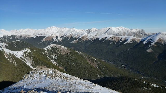
The view was
absolutely fantastic in all direction in terms of a small peak and the weather
was surprisingly ideal with mild wind. We sunbathed under blue-bird sky and
stayed one and a half hours on the top before descending the ridge
southeastward.
We descended
southeast along the ridge about 1.6 km, and then dropped down the slope on our
right/southwest on an animal trail. We left the animal trail and took advantage
of some scree here and there on the steep grassy slope to the bottom and then
bushwhacked back to the highway. From the highway, we simply walked west along
the road about 520 m back to our car to end this wonderful trip.

From the lay-by, hike back along the highway about 270 m to the start of the trail

No ribbons or cairns showing the trailhead

Look back to the lay-by parking

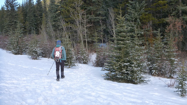
An obvious trail in the woods

The trail gradually gains elevation

The trail leads the way to a valley between Mist Mtn and Nameless Ridge

Approaching Nameless Col

Looking back from the col with Odlum Ridge in the back

Mist Mtn from Nameless Col

From the col, turn right and hike on thin snow covered grassy slope followed by rubble slope

A bit easy hands-on stuff to avoid those icy stuff on the ground

Pausing for gorgeous views

The route to Mist Mtn can be seen completely at this angle

Hands in the pockets section

Standing on the top of Nameless Ridge

View east across the valley and over Mist Ridge(L,F) and South Mist Hills(R,F) to (l-r) Shunga-la-she(L,B), unnamed, Highwood Peak(C), Lineham Ridge, Lineham Creek Peaks(1,2,3)

View SE

View south to Odlum Ridge with Continental Divide beyond

The outlier of Mist Mtn blocks most of the views to the SW

Mist Mtn dominates the view to the west-northwest

View northwest

Looking north-northwest to the distant (l-r) Outlaw Peak(C), Mt Glasgow(CR), Banded Peak, Cougar Mtn, and Mt Burns

Looking north-northeast across the valley to the long Mist Ridge with (l-r) Outlaw Peak, Mt Glasgow, Banded Peak, Cougar Mtn, Mt Burns(CL), Bluerock Mtn(CR), and Gibraltar Mtn forming the backdrop

l-r: Bluerock Mtn(L), Gibraltar Mtn(CL), Shunga-la-she(CR), and unnamed peak beyond Mist Ridge to the northeast

A close-up of Shunga-la-she(L) and unnamed peak(C)

Highwood Peak(L) and Lineham Ridge(R) towering over South Mist Hills to the southeast

A closer look at (l-r) Lineham Ridge(L), Lineham Creek Peaks(C-CR), Serendipity Peak, Mt Head, and Holy Cross Mtn

Zooming in on Mt Burke(L) and Plateau Mtn(C,R) with Hell's Ridge(C) and Strawberry Hills(R) in front

A telephotograph of Storm Mtn(C)

The legendary hot spring becomes increasingly popular

A closer look at (l-r) Outlaw Peak(CL), Mt Glasgow(C), Banded Peak(CR), and Cougar Mtn

Mt Burns over Mist Ridge to the north

Zooming in on (l-r) Mt Glasgow, Banded Peak, and Cougar Mtn

Bluerock Mtn at right in the b/g to the northeast

Gibraltar Mtn beyond Mist Ridge to the northeast

Panorama from northwest/left to southeast/right

Shunga-la-she to the northeast

Highwood Peak in the b/g to the east-sotheast

The distant Mt Burke to the southeast

Mt Loomis(CL) and Mt Odlum(R) to the southwest

Mt McPhail(CL) and Mt Bishop(C) playing hide-and-seek to the south

Descending the ridge southeastward

Looking back at the summit of Nameless Ridge(CR) with Mist Mtn stealing the show at left

The beautiful Mist Mtn

Nice ridge walk

Mist Mtn dwarfs Nameless Ridge

Mist Mtn again

Will drop down this steep slope and then bushwhack back to the highway

Checking out the last highpoint before descending the steep slope on our right

A trail continues southeastward making a bigger loop than our descent route

Hiking down the slope on our right/southwest on an animal trail after about 1.6 km ridge walk

Negotiating the steep grassy slope on the way down

The steep slope foreshortens a bit

Looking back the blue sky

Descending to the bottom of the slope

Last glimpse of Odlum Ridge

Looking back our descent route

Navigating in the woods

Backed to the highway and walked west along the road about 520 m back to our car

Nameless/Eagle Ridge from the highway

The end.
No comments:
Post a Comment