Sunday,
10/14/2018, Twin Peaks (Cabin Ridge) – Oldman River Rd, Hwy940/Hwy40 S, South
Rockies, AB
· Round Trip 14.5km;
Elevation: 2529m; Elevation Gain: Net - 820m, accumulated - 1020m; RT Time: 7:50hrs
(9:30 - 17:20), ascent to north peak (true summit) - 4:30hrs, from north peak
to south peak - 0:50hrs, descent from SP to car - 1:40hrs, total break time - 0:50hrs;
Easy scramble in dry condition
· Books:
· Cabin Ridge - 2513 m (8,245ft),
50.0419N -114.493W, Located in the Livingstone River Valley north of Shale
Creek, east of Honeymoon Creek, and west of Spears Creek, Province: Alberta,
Headwater: Oldman, Major Valley: Oldman, Visible from Highway: 940S.
· Cabin Ridge is an eight kilometre
feature. The northern two high points of the ridge are named Twin Peaks.(from peakfinder.com)
Drive
From
Calgary, drive south on Hwy 2 / Deerfoot Trail past High River. Turn right onto
Hwy 540 and then turn left (south) onto Hwy 22 for about 14.3 km, turn right
onto a gravel road Hwy 532 for 25.6 km to the end, turn left onto Hwy 40/Forest
Trunk Rd heading south for 28.3 km, then turn right driving west then northwest
on Oldman River Rd for 13.8 km, park in the clearing to the right. Driving time
would be around 3:00 hours.
We drove via Hwy 533 this time for a need of restroom stop, which made
the drive a little bit longer. The driving was pleasant in the early morning
until we drove on Hwy 532. Even though the snow-covered gravel road wasn’t too
slippery, I had to drive very slowly under the threat of the picture that the
car might slip off the cliff to the left. Fortunately, the way in is mostly uphill
and on the mountain side and I would not be the one driving out. Once turned
left onto Hwy 40 S, it was relatively easy and I was able to drive much faster
around 60-80 km/h. The Oldman River Road was also in decent condition and not
as threatening as Hwy 532.
Hike
The trail to Twin Peaks is not terribly long, but
the drive to its trailhead is. In order to sleep a little longer, we decided to
eat our breakfast during the driving. So we got up at 5am and managed to leave
home at 6am – half an hour earlier than usual but half an hour later than what
I planned.
After a long drive, we stretched our legs a
bit before heading east on a well packed logging road. Soon we bore left hiking
northward at where the road forks. Within Half an hour from trailhead, we
stepped into a meadow and followed an ATV track up a hill only to find that it led
to a wrong direction. So we took a sharp left turn and regained the correct old
logging road but completely missed the cutline that I planned to follow. This
logging road was a bit overgrown and required some bushwhacking. The horse tracks on the left edge of the new growth brought us up and out of trees
where the route to Cabin Ridge was open-and-shut. Our plan was to summit the
north peak first and then traverse to south peak if we have enough time. So we
contoured in boot-deep snow along the west slope below south peak to the col
between north and south peaks, and then hiked up the ridge towards north peak
with the cloud rolling in and the wind howling around us. After carefully doing
some easy to moderate scrambles over some blocks in snowy condition, we stood
on the top of the highest point of Cabin Ridge beside a small cairn with a wood
stick.
Well before we reached the summit, the weather
had deteriorated sharply, and the clouds had darkened the sky by the time we
were there. It was also too chilly to stay long in the cold wind. After taking
some pictures, we backed down a bit and sheltered behind the ridge wall to take
a meal break and warm up our fingers before heading to south peak.
The ridge walk towards south peak was easy and
enjoyable even in snowy and windy condition. And the more delightful thing was
the sky began to clear, hence much better scenery to be fully appreciated from
the south peak before going down.
The descent from the south peak was quick and mainly
a back-track except taking two shortcuts. The first one was a narrow cutline
with ribbons, and the second one was a bushwhacking. It took us 1:40 hours back
to the car, but we did run a bit in order to get back before 5:30pm since I
wanted to finish all rough drive, especially Hwy 532, before the dark set in.
however, we ended up still driving on Hwy 940 northward when it got dark. Anyway,
something unexpected may happen any time.
When drove on Hwy 532 for a little while,
there was a car coming on the opposite direction. We stopped to allow it
passed. Going forward to a wider section, another car approached from the
opposite, so we drove very slowly to pass, and the tough-looking driver blew
his horn behind us. We didn’t want to risk our safety, so we kept driving, but
then we encountered the third car. This time we were aware of something abnormal,
sure enough, the driver told us that it was so slippery that the car might slip
and fall off the cliff. Even though we didn’t see the road condition ourselves,
we still didn’t want to take any chance. Therefore, after letting 3 more cars
went by, we turned around and took the safer route of Hwy 940/Forest Trunk Rd
instead. Since the cars we stopped to let them pass were too slow, we were
still in the area when the sun set completely. Fortunately, they let us
overtake in a wide section and we were able to drive as faster as the condition
allowed and eventually backed home safe and sound.
I think, in winter condition, we better avoid
the cliffy section of Hwy 532; it is safety first, after all.
My track

Heading east on a well packed logging road
Soon bear left at where the road forks
Hiking northward
My track

Heading east on a well packed logging road

Soon bear left at where the road forks

Hiking northward

First glance of the south peak of Twin Peaks

Looking down the meadow just crossed from the old logging road. Red line should be the correct route, and green line leads to the cutline route that I planned to follow.

Following the horse tracks on the left edge of the new growth

This logging road was a bit overgrown and required some bushwhacking in places


The summit (north peak) of Twin Peaks

Keep following the horse tracks
Interesting cloud formation

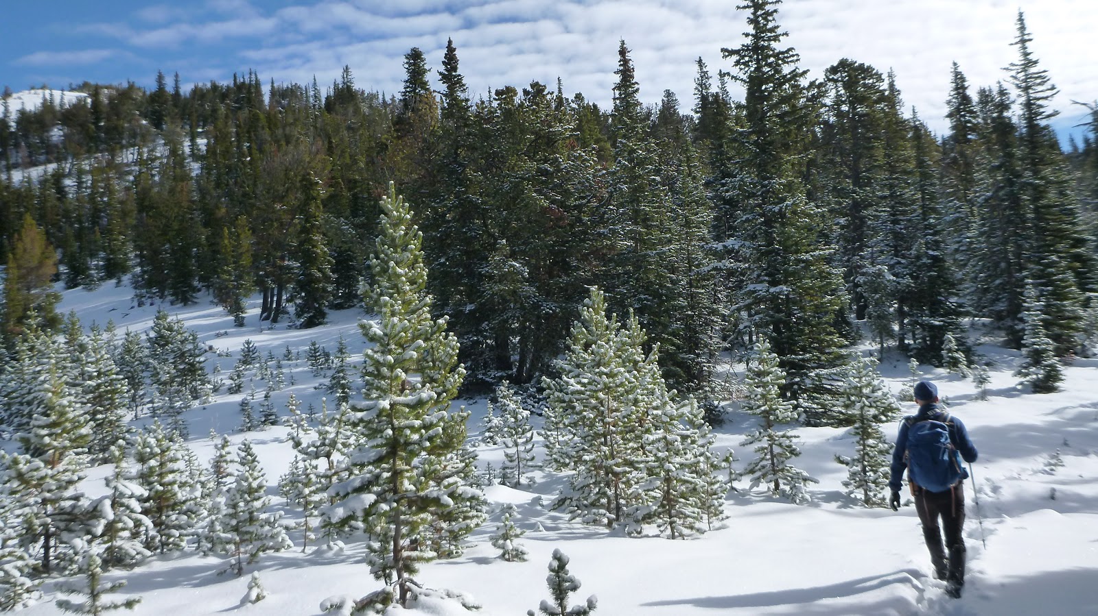
Hiking through thin forest

Beautiful tree and clouds

No more horse tracks

View back towards High Rock Range


Once out of trees, the route to Cabin Ridge became open-and-shut

A Pano to the west

The Elevators in a unique shape

A closeup of Gould Dome(L) and Tornado Mtn(R)

Beehive Mtn (L) and Mt Lyall (CR)

Mt Gass (L) and Mt O'Rourke (R)

Monad Peak(R) to the north

Following the ridge with north peak(L) in eye

Gould Dome to the SW

Tornado Mtn to the SW
Looking back. The ascent valley at left with (l-r) Tornado Mtn(L), The Elevators, and Beehive Mtn(R) forming the backdrop

Tornado Mtn to the SW

Looking back. The ascent valley at left with (l-r) Tornado Mtn(L), The Elevators, and Beehive Mtn(R) forming the backdrop

Can go over the ridge crest or go around the right side

Traversing to the col below the south peak

Contouring in boot-deep snow along the west slope below south peak towards the col between north and south peaks

Almost hit the col

Looking back from the col

Hiking up the ridge towards north peak with the cloud rolling in and the wind howling around us

Admiring the south peak

Carefully doing some easy to moderate scrambles over some blocks in snowy condition

Stay on the ridge crest

Negotiating deep snow here

Some more hands on stuff before summitting

The summit cairn is visible now

Standing on the top of the highest point of Cabin Ridge - the summit of Twin Peaks

Looking north through the gap between Monad(L,F) and Monola(R,F) Peaks towards the peaks on the skyline including (l-r) Mt Head, Holy Cross Mtn(CL), and Plateau Mtn(C)

Zooming in on (l-r) Mt Head(L),Holy Cross Mtn, Bull Creek Hills(CL), and Plateau Mtn(C)

View NW towards the Continental Divide

View NE with Mt Livingstone(CL) and Coffin Mtn (C) in the b/g

Looking east over the small summit cairn to Coffin Mtn (L) and Chaffen Ridge(R)

View SE with Chaffen Ridge lightly left of centre in the background

View south-southeast with Thunder Mtn(CL), Lightning Peak(C), and Centre Peak(CR) in the mid ground

Looking south over the south peak of Twin Peaks(L,F) towards Crowsnest Pass area

View south-southwest

West view

Zooming in on Mt Head(C) and Holy Cross Mtn(CR)

Plateau Mtn in a close shot

Too chilly to stay long in the cold wind

Backing down a bit for shelters

Keep heading to south peak after taking a meal break and warming up our fingers

Clearing sky to the northeast

Traversing east/left side of the right to shelter from the wind

Back on the ridge crest

Looking back to the north peak

The blowing wind swallowed his legs

On the top of south peak under a lightening sky

A more bright Look of Coffin Mtn (L) and Chaffen Ridge(R) to the east

To the southeast, the undulant ridges seem to stretch endlessly

A sea of peaks to the south looked blurry

Tornado Mtn(L), The Elevators(CR), and Beehive Mtn(R) to the SW

Looking north-northwest to High Rock Range including (l-r) Beehive Mtn, Mt Lyall, Mt Gass, Mt O'Rourke, Mt Pierce, and Mt Farquhar

View NW towards Monad Peak(C/CR) and the north peak (R) of Twin Peaks

View north with Plateau Mtn shining in the sun on the horizon

View NE

Better view of Mt Livingstone(L) and Coffin Mtn(CR) to the NE

Chaffen Ridge at right

Vague mountain figures to the south

A close shot of Gould Dome

and Tornado Mtn

and The Elevators(C)

The Elevators(L) and Beehive Mtn(CR)

l-r: Beehive Mtn, Mt Lyall and Mt Grass to the west-northwest

Mt O'Rourke just left of center to the northwest

Zooming in on the north summit with Mt Head(CL,B) and Holy Cross Mtn(R of Head) to its distant left, Bull Creek Hills to its distant right

Plateau Mtn to the far north

Monola Peak in the foreground with Plateau Mtn peeks from behind its left shoulder, and Sentinel Peak and Hailstone Butte arise from behind its right one

More shiny look of Mt Livingstone(L) and Coffin Mtn(C)

Going down from the south peak

Almost rejoin the ascent route

Backtracking

Love the valley along the way back

Looking back to south peak and the track on the slope

Sidesloping towards the lower ascent ridge

The hardly seen ribbon indicated the start of the first shortcut we took on descent

It was a narrow cutline with ribbons


Back on the old logging road after another shortcut in the bush

The cutline we missed on ascent

The cutline leads to the meadow

Looking back across the meadow to the cutline entrance

Hardly find the cutline from outside

Back on the trail

Back to the car on time

The end.
No comments:
Post a Comment