Sunday,
9/23/2018, Mackay Hills – Hwy40, Elbow-Sheep Wildland PP, Kananaskis, AB
· Round Trip 18.5km;
Elevation: NP - 2444m, CP - 2464m, SP - 2360m; Elevation Gain: net - 912m,
accumulated - 1545m; Time: RT - 9:55hrs (8:55 - 18:50), ascent to north peak - 3:25hrs,
from north peak to centre peak - 0:50hrs, from centre peak to south peak - 0:20hrs,
descent from SP to trailhead - 3:30hrs, total break time - 1:50hrs; easy
scramble with short section of dense bushwhacking on initial descent
· Books: ‘Gillean
Daffern’s Kananaskis Country Trail Guide—Volume 1’ by Gillean Daffern
References:
· The Mackay Hills are a group of three
highpoints unofficially named by local hiking guidebook author Gillean Daffern
and located east of The Wedge, west of Even-Tomas Creek.
Drive
From Calgary, drive west on Hwy 1 for about 60
km, then take exit 118 heading south on Hwy 40 for about 30 km to Wedge Pond,
turn left and park in the far side of the parking lot. Driving time would be around 1:10
hours.
Hike
On the first day of autumn, we preferred a hike with
fall colours to those meaningless TV shows, but didn’t want to have a long
drive and take any risk associated with the great amount of snow fell these
days, so we figured that Mackay Hills would be an appropriate object for the
day.
After comparing all reports from the internet,
we chose to do a loop in counter-clockwise direction like Autumn sky and Matt Clay did by
starting from Wedge Pond, picking up a trail to The Wedge, traversing below The
Wedge’s east face, heading east to Mackay Hills, traversing all three peaks of
Mackay Hills, descending east from the south peak to connect up with a horse
trail that runs northward and cuts across the wooded slopes all the way down to
Evan-Thomas Creek, connecting to the Evan-Thomas Trail and following it, and
going back to the car via Wedge Connector Trail.
The trail up The Wedge was a bit overgrown and
wet our pants and boots because of the snow fall the night before. We were also
scared by the fresh cougar footprints half an hour before popping out of the
trees. The only bushwhacking we encountered was on the descent to connect up
with a horse trail, but fortunately, it was short and most of the time we were
able to find animal trails to make it even easier. The weather was unstable but
at least we just had periods of flurry during the whole hike. The scenery
during this hike was reasonably great with minimal efforts, and I think we will
do it again when we are getting older.

From parking, head south-southwest towards the pond for a little while then pick up a trail leading to The Wedge on the left side

The initial trail was a bit overgrown

Kidd South(L) and Mt Kidd(R) across the valley in the back

Scared by the fresh cougar footprints half an hour before popping out of the trees

Hiking up The Wedge's north ridge

The blue sky was a perfect foil for the golden larch

Looking back down the ridge to Wedge Pond with Mt Kidd(CL) beyond

The Wedge ahead

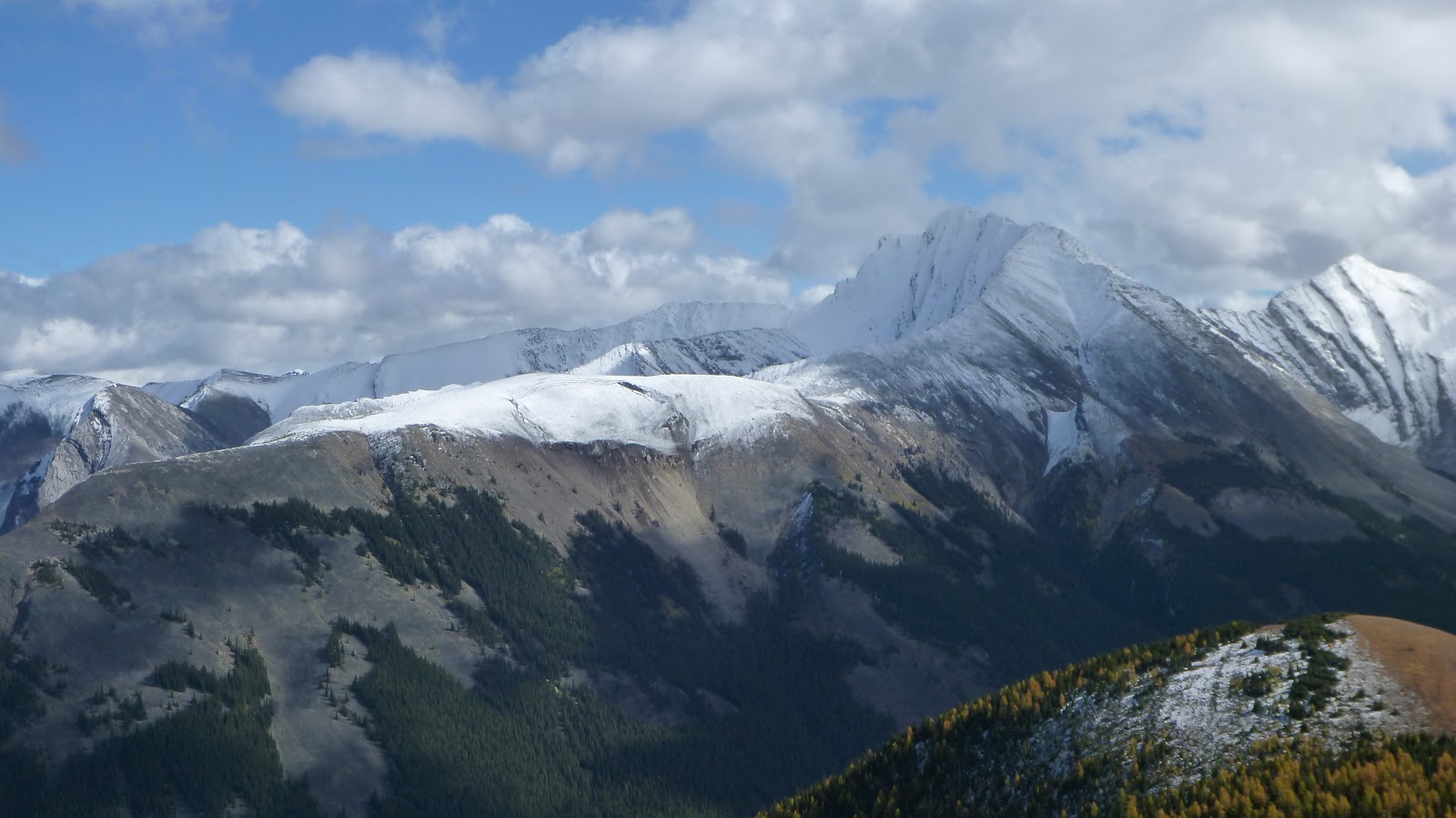
Looking southeast to the north(CL) and centre(CR) peaks of Mackay Hills with Fisher Peak beyond

Traversing below The Wedge’s east face

Looking back

Keep traversing

Admiring views during the traverse

Would cut the slope ahead

Heading east to Mackay Hills

Panorama from the ridge connects to Mackay Hills

Looking back to The Wedge on the way to Mackay Hills' north peak

On the summit of Mackay Hills

View east from the north peak

View south to Opal Range(L) and Ridge(C)

The Wedge directly to the west

View northwest with Kidd South(L) and Mt Kidd(CL) in the cloud

Looking north-northeast towards (l-r) Skogan Peak, Mt Lorette, Wasootch Peak, Kananaskis Peak(CL), Old Baldy Mtn(CR), and Mt McDougall(R)

Old Baldy Mtn at left

Mt McDougall(CL) beyond Volcano Peak(L,F) to the northeast

Unnamed peaks across the valley to the east

Heading southeast towards Mackay Hills' centre peak with Fisher peak beyond

Looking up the centre peak from the col

Hiking through rocks on the ridge leading to the centre peak

Looking back to the south peak with The Wedge towering above at left

Hitting snow

Easy terrain with thin snow

Easy scramble became a bit tricky with snow and ice

The last bit

On the summit of Mackay Hills' centre peak

Beautiful scenery to the east with Fisher Peak beyond our last object - Mackay Hills' south peak to the right of centre

Another gorgeous view to the southeast with (l-r) Mounts Evan-Thomas, Potts, and Denny at right

Looking south with Mt Denny(C) directly in the front

View southwest with Opal Ridge in dark shadow

Cloudy views to the west-southwest with Kananaskis Range in the background

View west-northwest to The Wedge(C) and south peak(R)

View northwest

View north

North-northeast view

View northeast

Panorama from north/left to southeast/right from centre peak of Mackay Hills

Closeup of Fisher Peak to the southeast
l-r: Wind Mtn, Mt Allan(CL) and Mt Collembola in the background to the northwest

Old Baldy Mtn(CL) and Mt McDougall(R) beyond Old Baldy Ridge(L) and Volcano Peak(CR) to the northeast

A telephoto shot of Cloud-covered Mt James Walker to the Southwest

l-r: The Fortress, Mt Gusty, and Mt Galatea across Hwy 40 to the west

Clearly seeing the summit of Fisher Peak

A close shot of Kidd South to the northwest

To the northwest, Mt Kidd towering above the south peak of Mackay Hills with Mt Bogart and Wind Mtn peeking from behind its left and right shoulder respectively

Skogan Peak(CL) and Mt Lorette(CR) without snow-effect to the northwest

Old Baldy Ridge(C) and Mtn(R) to the northeast

Volcano Peak(L,F) and Mt McDougall(R) to the northeast

Fisher Peak again

Descending the centre peak

Looking back at centre peak

The tiny south peak ahead

Pano on the way to the south peak

The flat top of the south peak

Admiring golden larch

The mighty Fisher Peak stole the show

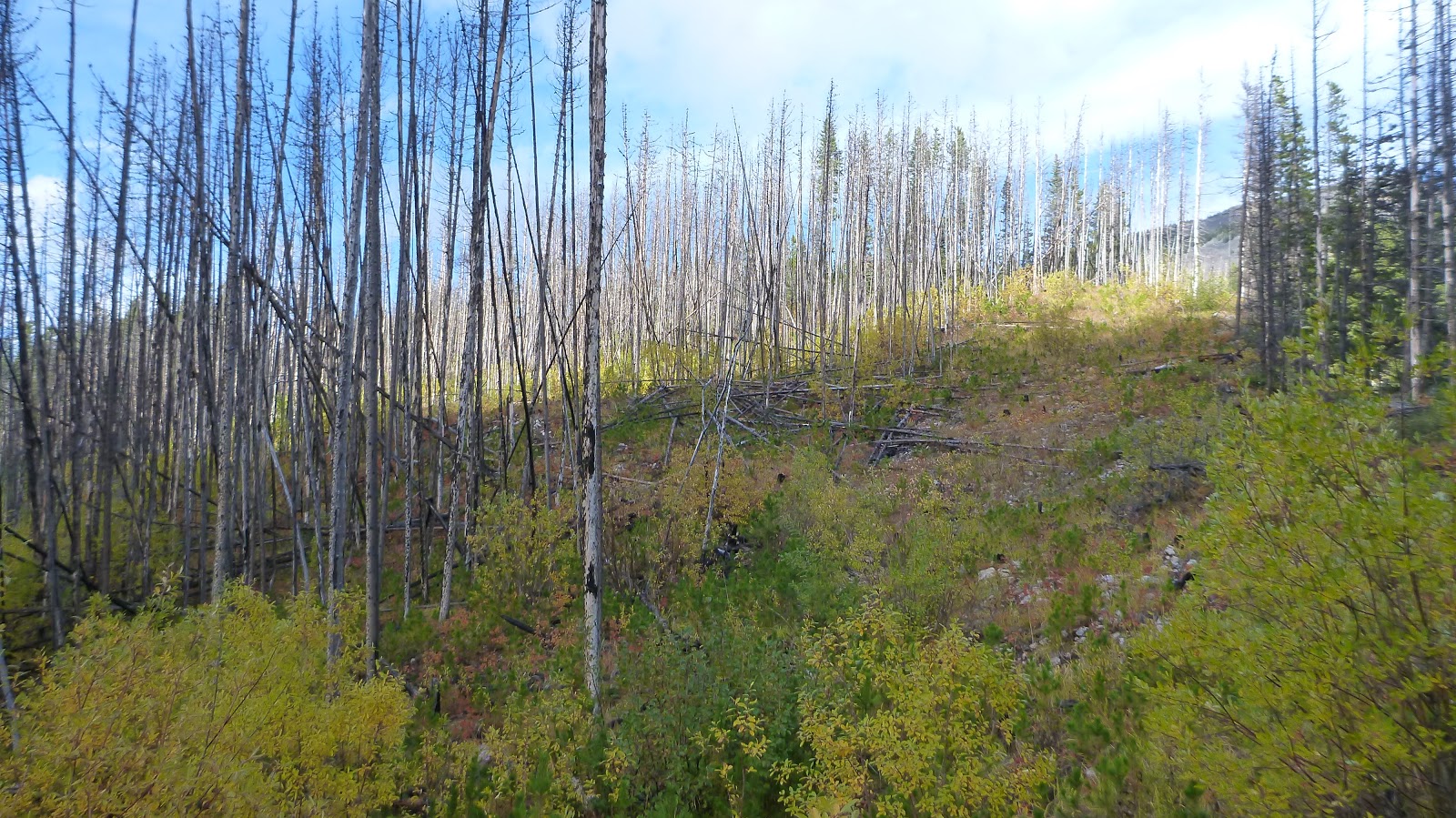
The only bushwhacking encountered when descending east from the south peak to connect up with a horse trail that runs northward and cuts across the wooded slopes all the way down to Evan-Thomas Creek

Small but identifiable animal trail leads to the horse trail

This animal trail cuts the south peak's east slope

On the horse trail

Down to Evan-Thomas Creek

Crossing Evan-Thomas Creek with a beautiful cascade in the background

Picking up the trail at left

Through a camp at fine spot

On the trail connecting to Evan-Thomas Trail

A fire scar on the way back
The spot connecting to Evan-Thomas Trail

Leaving Evan-Thomas Trail to the Wedge Connector Trail

One of the two bridges on the Wedge Connector Trail

Following the Wedge Connector Trail back to the car

The end.
No comments:
Post a Comment