· Round Trip 15.3km;
Elevation: 2702m; Elevation Gain: 980m; Time: RT – 7:35hrs (09:15-16:50),
ascent – 3:30hrs, descent – 2:30hrs; Easy scramble
· Books: ‘Scrambles in the
Canadian Rockies’ by Alan Kane
References:
Drive
From Calgary, drive
west on Hwy 1 for about 167km and take the exit for Lake Louise, turn right and
drive about 1.6km towards the Lake Louise ski area. Turn right (Skoki Lodge
sign here) and follow the gravel road for 1km to the Fish Creek / Skoki Lodge
parking lot on the right side of the road or just park on the left side of the
road before the gate.
On foot
While we were gearing up, a park staff walked down from her
truck and told us that there was a grizzly wandering along the road towards the
ski hills on the other (north) side 10 minutes ago. After knowing that we had
bear spray and would make noise frequently she left.
The news of a grizzly nearby
excited and alarmed us at the same time, so we kept our ears and eyes open and yelled
regularly while hiking up the 3.8 km Temple Lodge access road. Once on the
trail for Hidden Lake and Skoki Lodge, we encountered some snow patches and
muddy sections, but we just needed to follow it for about 600 metres well
before the first bridged creek crossing along the trail, and then turn right
into the trees. We bushwhacked a bit at first then found a path heading E/NE
along the right side of a creek. The path soon covered by wet and unsupportive
snow, and sometimes we had to detour around into thick woods to avoid deep snow.
One and a half hours later, we entered into the Wolverine Valley and had some open
views to our left. We crossed the creek to its left (NE) side here on a snow
bridge resulted from a previous avalanche activity to escape from the trees and
snow on the right side of the creek. When realizing we had stepped into a bog-like
soaking meadow, we tried to go up more left, but were forced to go back down to the
meadow because of the nasty bushwhacking. At the time we could see the ascent
slope from afar, we cut the meadow diagonally, crossing through several snow
and boulder fields, to reach the lower part of the ascent slope we aimed for.
This grassy slope is quite steep, but with the help of the vegetation, we
quickly got to the top of the first rock bank and then traversed under the
second rock bank to the col between Redoubt’s southern outlier and Unity Peak.
From the col, it was an easy stroll to the shoulder below the summit block. I
stopped here for some photos while Gua headed to the summit by descending a bit
then ascending the west slope well below the summit. Suddenly, I heard a loud crash
coming from Gua’s direction, and then saw a big rock tumbling down. My heart
sank immediately and my eyes wide open to search Gua’s figure. I breathed again
only when I saw his hard-to-recognized tiny form in the shade of the big
boulders and heard his response. Fortunately, he was able to release the rock
when it was about to fall and just had some shallow scratches on his left arm. We
reunited on the ridge top, and then took turns to climb up the highest point of
Unity Peak since the summit is a big piece of downward sloping boulder that
only has room for one person.
The weather was way better than the
forecast. It wasn’t overcast at all, but almost a bluebird day and the views up
there were spectacular. We took our time to admire the views and identified the
mountains in all direction before heading down the same way we came.

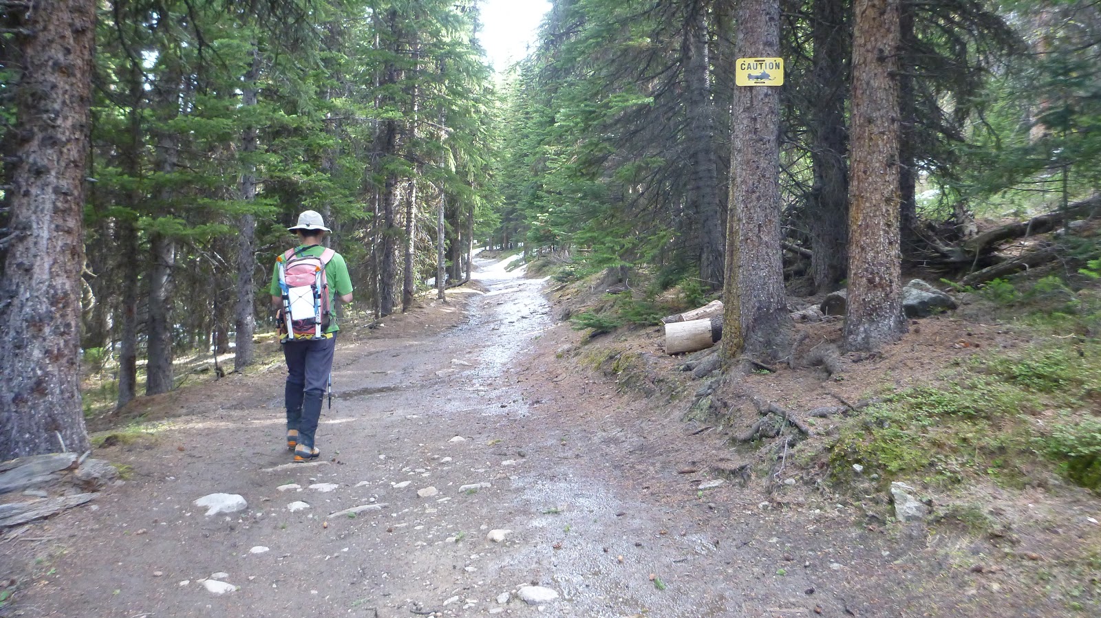
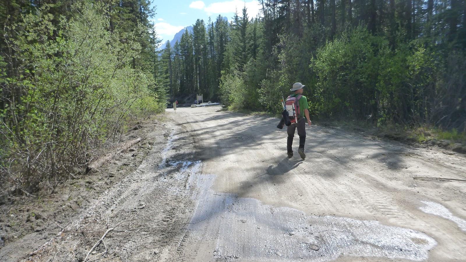
Start hiking up the 3.8 km Temple Lodge access road

Entering the trail for Hidden Lake and Skoki Lodge

The trail was a little muddy
After following the trail for about 600 metres before the first bridged creek crossing along the trail, we turned right into the trees

Found a path heading E/NE along the right side of a creek after a bit bushwhacking

The path soon covered by wet and unsupportive snow

Entering into the Wolverine Valley and had some open views to our left

Trying to go up more left when realizing we had stepped into a bog-like soaking meadow

But forced to go back down to the meadow because of the nasty bushwhacking

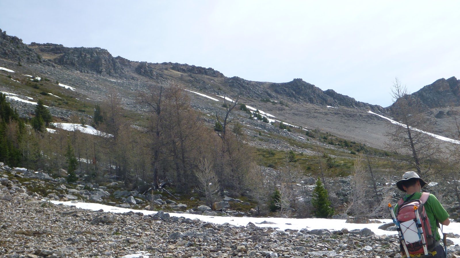
At the time we could see the ascent slope from afar, we cut the meadow diagonally, crossing through several snow and boulder fields, to reach the lower part of the ascent slope we aimed for.

A pano revels a beautiful and peaceful meadow

Aiming for the ascent slope

Fine-shale slope on the right of our ascent slope grants a quick descent

Admiring Great views

This slope is much steeper than it looks

On the top of the first rock bank

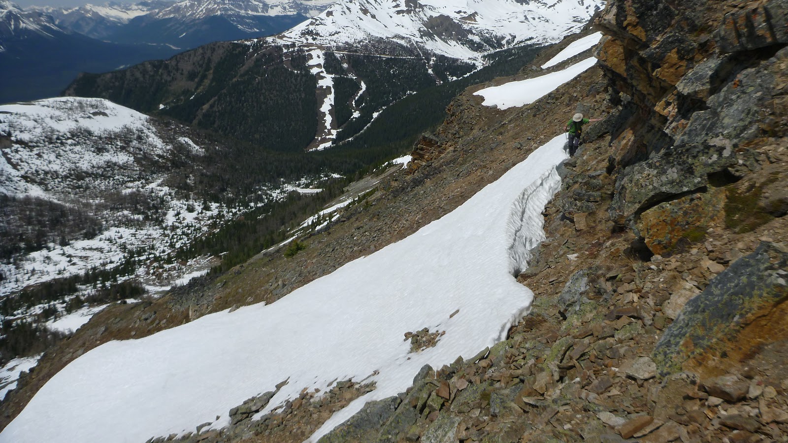
Traversing under the second rock bank

Looking back
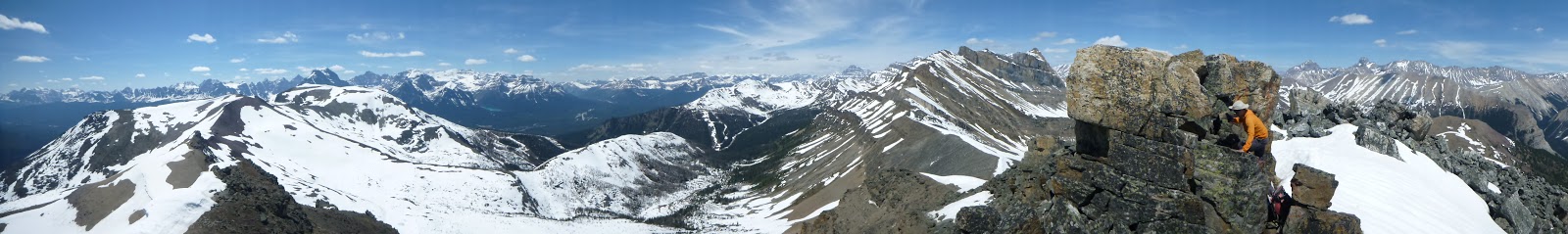
View from the col


A Pano from the col between Unity Peak(L/SE) and Redoubt Mtn(R/N)

The col is a bit rocky

From the col, it was an easy stroll to the shoulder below the summit block
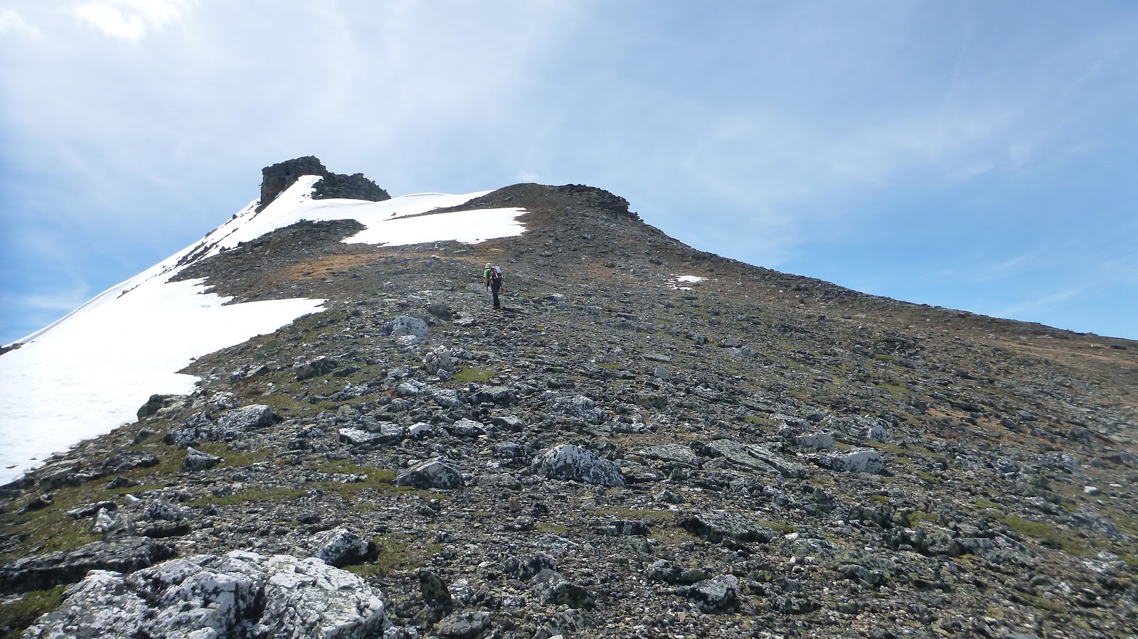
Looking at the summit of Unity Peak(CR) from the shoulder

The obvious route up

Standing on the boulder with a plaque explaining the naming of this peak

Will climb the highest point from this side

Standing on the top of Unity Peak surrounded by wonderful views


Had to take turns to climb up the highest point

Another angle of the Summit

Looking southeast to (l-r) Mt Avens, Pulsatilla Mtn(CR), Bulwark Peak(CR), Armor Peak, and Protection Mtn

Mt Assiniboine in the distance

A distant/vague view to the southeast with Mt Assiniboine to the far left

A closer look towards south-southeast at Storm Mtn, Mt Ball(CL), and Stanley Peak(R)

Looking southwest over Purple Peak and Lipalian Mtn to the Lake Louise group

l-r: Mounts Fay, Babel, Little(glaciated), Bowlen, and Tonsa Peak, and Mounts Perren, Allen, Tuzo, and Deltaform Mtn, Mt Temple beyond Purple Peak and Lipalian Mtn

A closeup of Mt Temple

l-r: Mt Whymper(L,B), Mt Bell, Panorama Peak(CR) and Ridge, Bident and Quadra(R) Mountains to the southwest

Looking southwest to (l-r) Mt Temple, Hungabee Mtn(C), Ringrose Peak, Mt Lefroy(R,B), with Mt Aberdeen, Haddo Peak, Sheol Mtn and Saddle Mtn in front of Lefroy.

Beautiful view towards Lake Louise and Mt Victoria(CL)

Hungabee Mtn(L), Ringrose Peak, Mt Lefroy(CR,B), with Mt Aberdeen, Haddo Peak, Sheol Mtn and Saddle Mtn in front of Lefroy.

l-r: Mounts Lefroy, Victoria(C,B), and Whyte beyond Fairview Mtn(CL,F) and over Lake Louise to the SW

Wapta Mtn(CL) and Mt Carnarvon(R) in the background to the west- northwest

Looking west towards Field and Yoho NP

Mt Carnarvon beyond Mt Ogden to the northwest

View northwest with Mt Bosworth(CL) in the foreground, Mt Carnarvon(L), The President(R) and The Vice President(R) in the background

Mt Niles(L) and Mt Daly(R) to the northwest

Mt Niles(L), Mt Daly(C), and Mt Balfour(R) in the skyline

Zooming in on Mt Balfour(CL) with Mt Collie at right

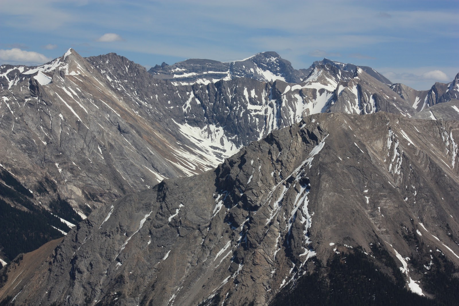
View north-northwest with Mt Hector in the background at left, Redoubt Mtn in the foreground at right

Mt Hector

Mt Richardson, the highest peak in Skoki area

The sheer wall of Redoubt

Looking north into Skoki area

l-r: Mt Douglas, Mt Saint Bride, and Lychnis Mtn(CL) beyond Anthozoan Mtn(C,F) to the northeast

Looking east-southeast to Bonnet Peak(L,B), Mt Avens(CR) and Pulsatilla Mtn(R,B)

From front to back: Redoubt Lake, Packer's Peak, Skoki Mtn with Cyclone(CL,B) and Pipestone(CR,B) Mountains forming a backdrop

Fossil Mtn at right

A close-up of Mt Douglas to the northeast

Mt Saint Bride(L) and Lychnis Mtn(CR) beyond Anthozoan Mtn to the northeast

Bonnet Peak(C/CR) in the background to the east
The sheer drop of (L-r) Bulwark Peak, Armor Peak, and Protection Mtn

Mt Avens(CL) and Pulsatilla Mtn(CR) to the southeast

A panorama (W-N-E) from the summit of Unity Peak

A panorama (L/NW to R/SE) from the summit of Unity Peak

A panorama view (E-S-W) from the summit of Unity Peak

N-E-SE

S-W-N
Heading down

Looking back to the summit

Getting down from the shoulder

Back to the col with Redoubt Mtn filling the background

Quick descent on fine scree

Going through the valley

Neither boulder nor snow was comfortable

Walk along the creek most of the time

Back to the trail


Walking down on the Temple Lodge access road

Back to the parking
The end.
No comments:
Post a Comment