Sunday, 6/03/2018,
Mt Fable – Hwy1A,
B.V.W.
PP, Exshaw, AB
· Round Trip 22.4km;
Elevation: 2713m; Elevation Gain: 1406m; Time: RT – 10:15hrs (8:45-19:00),
ascent – 5:30hrs, descent – 4:05hrs; Moderate to difficult scramble with some
exposure and a long approach on ankle-bitten creek bed
· Books: “Scrambles in the
Canadian Rockies” by Alan Kane
·
51.1175N
-115.226W. Located in the Exshaw Creek Valleyat the head of Cougar Creek. Province:
Alberta. Headwater: Bow. Visible from Highway 1.
·
Ascent Date:
1947. Ascent Party: R.C. Hind, L. Parker, J.F. Tarrant
·
Unofficially
named in 1947, it is said that a group attempted to climb the mountain in that
year but claimed they were unsuccessful due to heavy bush. A subsequent attempt
was successful without experiencing any difficulties, deciding that the story
of the heavy bush was a "fable." (From peakfinder.com).
Drive
From Calgary, drive west on Hwy 1 for about 63km and take exit 114/Seebe then
drive north on 1X for 4 km until a T intersection. Turn left/southwest towards
Exshaw for 7.5 km then turn right onto Mount Allen Drive for around 230 metres.
There is a small clearing, where we parked on our 2016 trip to Exshaw Ridge, on
the right side of the road right past the recycle area, but we didn’t use it
this time since a new no-parking sign there surprised us while the other sign
below it saying ‘staff parking only from Mon. to Fri.’ confused us. We eventually
re-parked our car on a small area between this clearing and the recycle area. Driving
time would be around 1 hour.
Hike
Mt Fable is an unfinished business for us back to 2012. We then totally
lost our interest and courage on repeating the long and boring creek bed approach
until recently. It doesn’t mean we change our attitude towards the approach. We
just have less and less choice after these years scrambling life, especially in
shoulder season when many mountains in the central Rockies are still
snow-capped.
The route to Mt Fable is straight forward but
involved approximately 8 km of flood-damaged creek bed floor, countless creek
crossing, steep scree slog, steep slab, and a short but a bit narrow and
exposed ridge. The hardest thing for me that day was the anklebiter creek bed
and time consuming creek crossing. In my memory of last attempt, there was a
trail on either side of the creek, but was apparently damaged by the 2013
flood. Therefore we made slow progress on Exshaw Creek and Fable Creek even
though we could occasionally find some faint trails in the woods to avoid
logjams. After 3:45 hours long trudge, we finally reached the headwall, where
we turned around last time, that precedes the scree slope leading to the col. We
then ascended the rock step on the right side of the headwall feeling better
and better when comparing to the monotonous creek bed.
From the col, a trail brought us up to the crest
where a small down climb was waiting for us. After the down climb, Gua climbed
up a gendarme blocking our way only to know it is a deadlock. So we went down a
little on the right side and followed a trail to the front of a slab. Using the
small cracks, we climbed up the slab with extra caution due to the exposure and
steepness. When we eventually topped up on the summit ridge, we abandoned the
easy scree ledge behind a confined crack on the right (SW) side of the ridge
because the crack is too narrow to pass through for Gua with a backpack on his
back, although we used it for our descent. The broken short ridge we preferred
was a fun scramble, but did involved one difficult and exposed move and a
narrow section well earned our respect. After that, we soon stood beside the unique
summit cairn - a metal cross.
By the time we reached the summit of Mt Fable,
the weather had gradually deteriorated and the blue bird sky in the morning had
been darkly clouded. However, this didn’t water down our joy of completing our
unfinished work, since if we didn’t summit this time, we might have to suffer
the horrible long approach again.
After 40 minutes stay, we left the summit by
walking back (NW) along the ridge for a short distance, and then got down to
the scree ledge we abandoned on our ascent. The climb up to the confined crack
was easy, but the crack itself was too narrow to go through. Gua had to climb over
the rock to the other side while I could barely squeeze my body through with
just a waist pack on me. We then followed our ascent line back to the col and
hiked the rest of exhausting deproach back to the car.

The trailhead

Mt Fable with blue bird sky from parking

It was an old dam last time we were here

Occasionally find some faint trails in the woods to avoid logjams in the creek bed

Turn left leaving Exshaw Creek

Fable Creek with Mt Fable peeking out at centre right

The snow below the col concerned us a bit

Taking advantage of the snow

Ascending the rock step on the right side of the headwall

The scree slope leading to the col
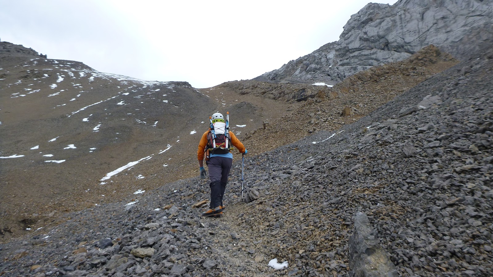
View from the col

From the col, a trail brought us up to the crest where a small down climb was waiting for us

The small down climb

The cairn indicates a correct route to bypass the gendarme from the right side of the ridge

Using the small cracks to climb up the slab with extra caution due to the exposure and steepness

Upper part of this slab

The angle of the slab

On the way up


The last bit to the summit ridge and the easy scree ledge behind a confined crack on the right (SW) side of the ridge

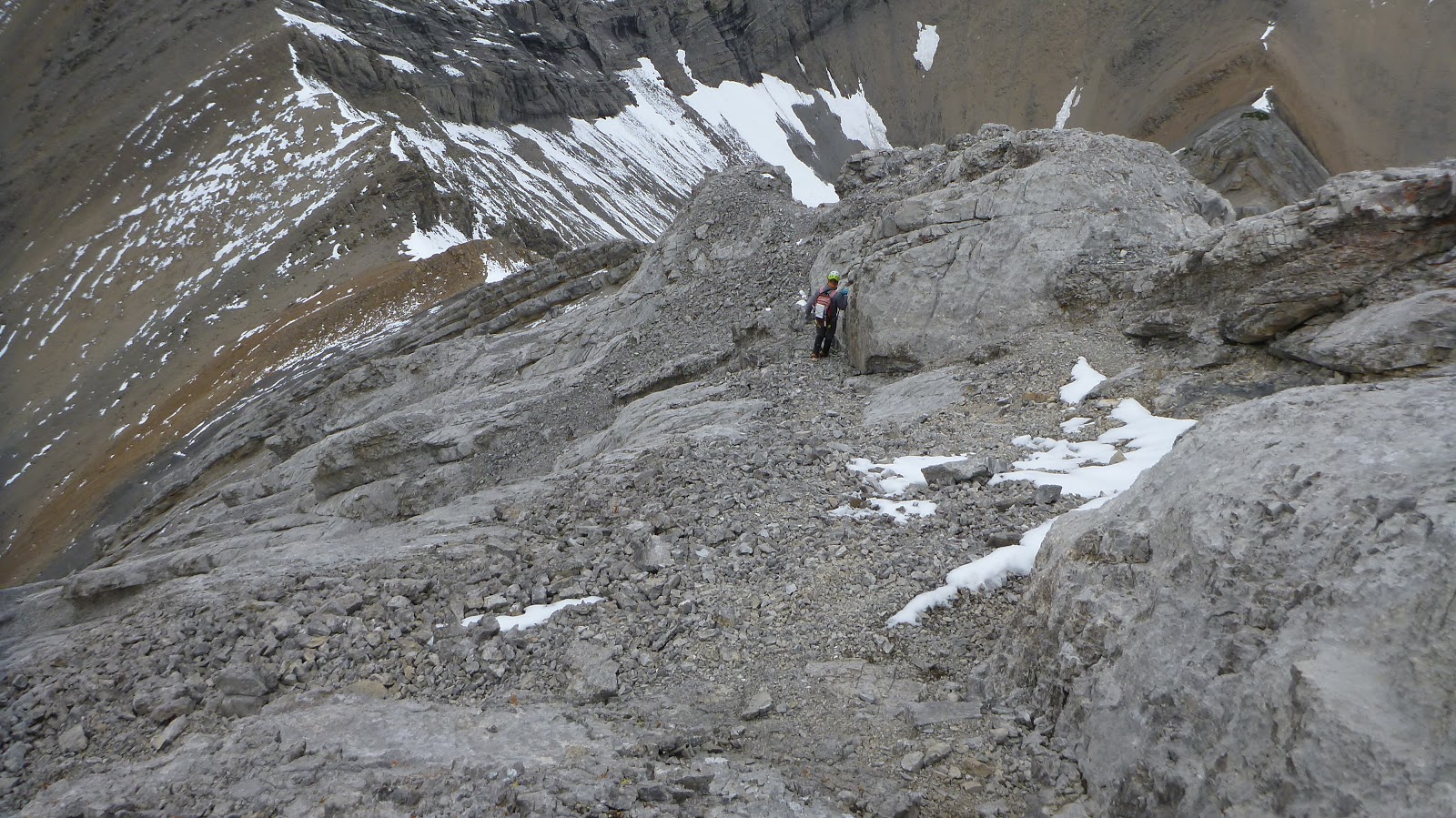
Start negotiating the broken short ridge

The difficult and exposed move


Followed by this

Easier section of the ridge

A narrow section

Standing beside the unique summit cairn - a metal cross

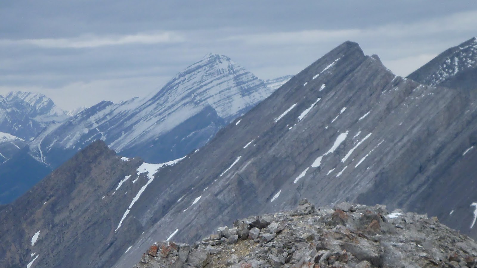
View east towards (l-r) Old Fort Peak (L), Goat Mtn(CL), Loder Peak(R), and Door Jam Mtn(rightmost)

View southeast

View south-southwest

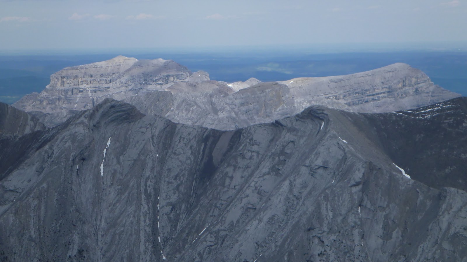
View southwest with (l-r) Mt Nestor, Old Goat Mtn(CL,B), and Three Sisters (C,B) rise above Windtower (L,M), Rimwall (CL,M), and Grotto Mtn(C,F)

View west-southwest

A closer look at (l-r) Mt Bogart, Wind Mtn, Lougheed 3, Mt Sparrowhawk, Mt Lougheed(C), Lougheed 1(CR), Windtower

View west-northwest: (l-r,f-b) Cougar Mtn(C), Mt Lady MacDonald(L), Mt Charles Stewart(R), and Mt Rundle (CL,B)

View northwest with Mounts Peechee(C), Girouard(C), and Aylmer(R) in the b/g

View north-northwest with Mt Townsend at right

View north with Mt Townsend at left

View northeast

View east-northeast over Exshaw ridge to Morrowmount (L) and Old Fort Peak(R)

Zooming in on Old Fort Peak(L) and Goat Mtn(R)

Fisher Peak to the southeast

A closeup of (l-r) Mt Bogart, Wind Mtn, Lougheed 3, Mt Sparrowhawk(C,B), Mt Lougheed(CR), and Lougheed 1 (R)

Mt Peechee and Mt Girouard to the northwest

Mt Aylmer still covered by snow
Mt Townsend might be good to go

End Mtn(L) and Association Peak(R) in the sun
A panorama from the summit of Mt Fable

Leaving the summit by walking back (NW) along the ridge for a short distance

Below the ridge to skier's left is the easy scree ledge abandoned on ascent

A closer look

Getting down to the scree ledge

Walking the scree ledge to the confined crack

The climb up to the confined crack was easy, but the crack itself was too narrow to go through

Had to climb over the rock to the other side


Looking back down through the crack

Could barely squeeze the body through the crack with just a waist pack on

Looking back at the scree ledge

Keep going down
On the ridge

The slabby section

Going around the gendarme

Going back up the ridge crest

Fun scrambling

Last slope to the col

Quick descend on scree

Looking back up the col

Looking back at the rock wall

Boot skiing on the snow filled gully

Typical terrain along the creek bed deproach

Finding a trail in the woods to avoid logjam in the creek bed


Back to the trailhead after a rather exhausting deproach with Heart Mtn in the background

The end.
No comments:
Post a Comment