Sunday, 6/19/2016, Bertha Peak – Evergreen Str., Waterton townsite/NP, AB
· Round Trip 16km;
Elevation: 2440m; Elevation Gain: 1150m; RT Time: 5-8hrs, ascent: 3-4hrs; Easy to
moderate scramble
· Books: ‘Scrambles
in the Canadian Rockies’ by Alan Kane
Thanks to the TR
as listed below:
· Located west of Upper Waterton Lake and
north of Bertha Creek. Waterton Park, Alberta Major headwater Oldman River. Latitude
49; 02; 20 Longitude 113; 56; 40, Topo map 82H/04. Panorama viewpoint: Sofa
Mountain Hill. Can be seen from Highway 5.
· Named by Morrison P. Bridgland in 1914.
Ekelund, Bertha (Bertha was an early resident of Waterton National Park.)
Unofficial name (from peakfinder.com).
车行路线:到达 Waterton 小镇后从
Hwy 5 向前(西南)驶上
Evergreen Ave 前行约1.1km 后在路牌指示下向右拐进 Bertha Lake 的停车场(49°02'49.2"N 113°55'01.5"W or 49.047005, -113.917077) 。如果住在 Townsite Campground 的话,可以不用开车,因为步行到 Bertha Lake 的停车场只需10分钟不到。
步行路线:在风雨飘摇的帐篷里得不到休息自然十分困倦疲累,首夜便被风吹折了帐篷更是令人心绪不宁,已全然没有了热情和信心去爬原计划有些难度的 Glendowan 了。但车窗外的蓝天白云让人不忍浪费光阴,于是决定收拾一下残局后去爬营地附近比较容易的 Bertha Peak。
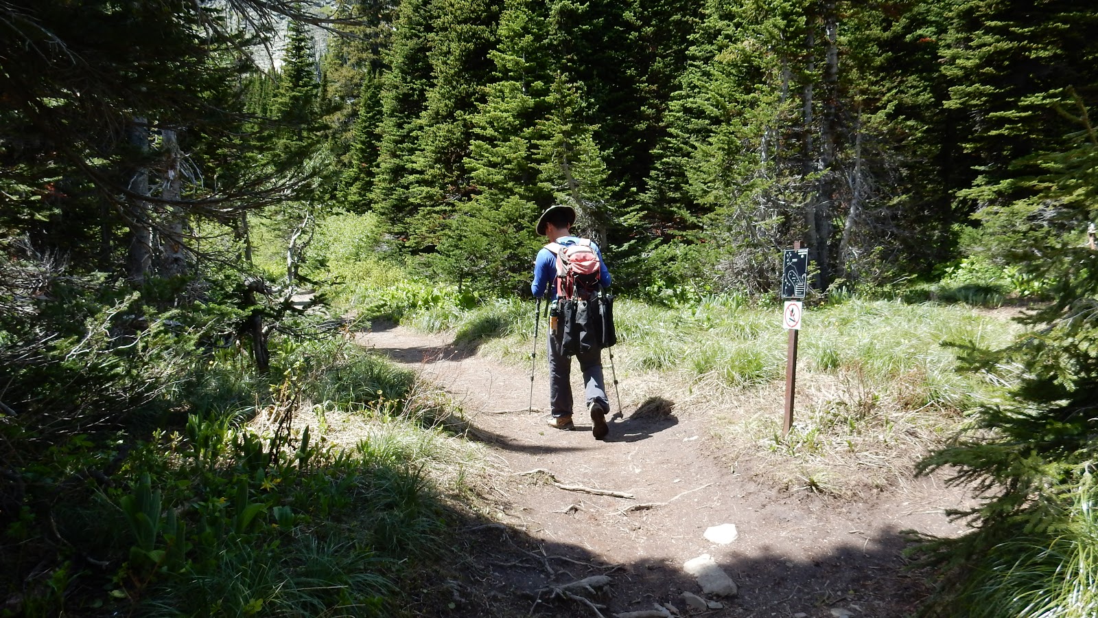
从营地跨过 Cameron Creek 往西步行不到10分钟便来到了 Bertha Lake 路径的起点,我们11:30am 从这里出发走在林木遮掩的小道上。开始1.4km 的小道比较平缓地向南延伸,拐向西行后在 Bertha Creek 旁蜿蜒的小道坡度渐增,在渐渐上行的小道上步行大约4km 便是多数人的终点 - Bertha Lake。而由于我们出发得较晚,在到达 Bertha Lake 之前与无数的游人擦肩而过,很多游客都被两旁的野花吸引着停下欣赏和拍摄。我其实也想像他们那样悠闲一下,但走在前面的瓜提醒了我还有很长的路要赶,只好拖着沉重的脚步挣扎着努力追赶。
到达 Bertha Lake 时已是1:20pm,我们沿着湖的右 (西) 岸前 (南) 行约900米后离开官道从右面的山肋往上爬。我们今天采用的是 Allan Kane 两条路线中较为容易的那条路线,基本上不需用手。我们沿着山肋向西北方向上爬近1km,踩着前人的足印走进一片积雪过膝的树林,从树林向北往下走一些,出了树林后面前就是 Bertha Peak 的西南面山坡,再从这面宽阔的山坡选择自己喜欢的线路向东北方向走上山脊,最后往左沿着山脊走至最北面的山顶。
我们今天有些精神不振,走得很慢,幸好此山比较简单,无需太费神,咬牙坚持前行终能到达终点,虽然3:30pm 有些晚。山上能俯瞰 Waterton Lakes,能远眺美国境内Glacier NP 里的高山,风景很美,但风大和困倦令我们有些提不起精神,便早些原路下山,着手解决睡的问题。
7pm 回到营地,我负责煮面,瓜则把被风吹折了一根支撑杆的帐篷用 duct tape 稍稍修复,再重新支起了帐篷。因担心再遭遇昨夜的大风,我们决定当晚不住帐篷而是睡在车上,只用帐篷存放非食物的物品。没想到的是,这次的意外让我喜欢上了睡在车上。车和帐篷相比,拥有平整安静没风的优点,不像睡在气垫上,太软而不利于腰背的健康,转身时还会影响到旁边的人;更不会听到别人的说话声,关车门声,走过的脚步声,以及风声。缺点是空间有限,站不起来,睡前要做很多功夫把窗户摭上。但是睡在车上的安静对我的吸引远远大于它带来的麻烦,现在我们要选择的不再是睡帐篷还是睡车上,而是考虑将来怎样可以不带帐篷而又能同时解决睡觉和储存物品这两大问题。
总结:
· 上山用时4小时0分,下山用时2小时40分,在山顶停留0小时40分钟,全程用时7小时20分。
· 这条路线没什么难度,比较简单,如果需要些挑战可以试试 Alan Kane 的另一条上山路线。
· 山上风景不错,值得再去。
My Route

从桥上跨过 Cameron Creek, 背景为昨日爬过的 Mt Crandell.

过桥后往西步行不到10分钟便来到了 Bertha Lake 路径的起点

从这里出发走在林木遮掩的小道上

按 Bertha Lake/Fall 的指示走

途中看到的 Bertha Peak

Bertha Fall

旖丽风光

多数人的终点 - Bertha Lake

Bertha Peak. 其中较难的路线在窄长瀑布的右边,我们采用较容易的路线,即左边伸向图外的山脊。

途经一个露营地

沿着湖的右 (西) 岸前 (南) 行约900米后在此离开官道从右面的山肋往上爬

山肋初段情况

站在山肋上往下看,湖水碧波荡漾。

小道在此有些隐秘

途况


我们沿着山肋向西北方向上爬近1km,踩着前人的足印走进一片积雪过膝的树林,从树林向北往下走一些。

出了树林后面前就是 Bertha Peak 的西南面山坡

从这面宽阔的山坡选择自己喜欢的线路向东北方向走上山脊,最后往左沿着山脊走至最北面的山顶。

回望最后一段山脊

The summit of Bertha Peak

东面立于 Waterton Lakes 之上的 Vimy Peak(C,F), Sofa Mtn(CR,B), 和 Mt Boswell(R,F).

Looking SE towards Glacier NP with its landmark Mt Cleveland(C,B) covered by cloud in the background

A long vertical cliff connects Mounts Richards(L) and Alderson(R) to the south-southwest

Mounts Alderson and Carthew blocks the views to the SW

Mt Carthew(CL) and Buchanan Peak(CR) dominate the view to the west

The backdrop to the NW is formed by (l-r) Mt Lineham, Mt Blakiston, Newman Peak, Mt Glendowan, Cloudy Peak, and Mt Dungarvan.

Looking north to Mt Crandell(C,F) with Mounts Dungarvan(L,B) and Galwey(CL,B) to its left

A zooming-in view towards Vimy Peak(CL,F) and Ridge with Sofa Mtn(C,B) beyond

Mt Boswell in the foreground with Crypt peak(C,red) beyond

Kaina Mtn rises above Miche Wabun Peak in GNP

The snowy Cathedral Peak(CL,B) in the Glacier NP makes her appearance behind Wahcheechee Mtn(CL,Middle)

Mt Richards(summit at right) in the foreground

Looking SW over the ridge between Mounts Richards(L) and Alderson(R) towards the other side of the border

Mounts Alderson(L) and Carthew(R)

Mt Lineham (L) and Mt Blakiston (CR) beyond Buchanan (F) and Ruby (M) Ridges to the NW

Newman Peak(L), Loaf Mtn (C,B) and Mt Glendowan to the NW

Looking NW-N towards (l-r) Mt Glendowan, Cloudy Peak, Mt Dungarvan, and Mt Galwey

Mt Crandell in the afternoon sun to the north

A panorama (L/SW - R/N) from the summit of Bertha Peak

A panorama (L/NE - R/S) from the summit of Bertha Peak

Heading back

往上然后往左穿过这片还有积雪的树林

Waterton Lakes 和 Bertha Lake 有着截然不同的色彩

Bertha Lake

Bear grass

回到起点

The end.

从桥上跨过 Cameron Creek, 背景为昨日爬过的 Mt Crandell.

过桥后往西步行不到10分钟便来到了 Bertha Lake 路径的起点

从这里出发走在林木遮掩的小道上

按 Bertha Lake/Fall 的指示走

途中看到的 Bertha Peak

Bertha Fall

旖丽风光

多数人的终点 - Bertha Lake

Bertha Peak. 其中较难的路线在窄长瀑布的右边,我们采用较容易的路线,即左边伸向图外的山脊。

途经一个露营地
沿着湖的右 (西) 岸前 (南) 行约900米后在此离开官道从右面的山肋往上爬

山肋初段情况

站在山肋上往下看,湖水碧波荡漾。

小道在此有些隐秘

途况


我们沿着山肋向西北方向上爬近1km,踩着前人的足印走进一片积雪过膝的树林,从树林向北往下走一些。

出了树林后面前就是 Bertha Peak 的西南面山坡

从这面宽阔的山坡选择自己喜欢的线路向东北方向走上山脊,最后往左沿着山脊走至最北面的山顶。

回望最后一段山脊

The summit of Bertha Peak

东面立于 Waterton Lakes 之上的 Vimy Peak(C,F), Sofa Mtn(CR,B), 和 Mt Boswell(R,F).

Looking SE towards Glacier NP with its landmark Mt Cleveland(C,B) covered by cloud in the background

A long vertical cliff connects Mounts Richards(L) and Alderson(R) to the south-southwest

Mounts Alderson and Carthew blocks the views to the SW

Mt Carthew(CL) and Buchanan Peak(CR) dominate the view to the west

The backdrop to the NW is formed by (l-r) Mt Lineham, Mt Blakiston, Newman Peak, Mt Glendowan, Cloudy Peak, and Mt Dungarvan.

Looking north to Mt Crandell(C,F) with Mounts Dungarvan(L,B) and Galwey(CL,B) to its left

A zooming-in view towards Vimy Peak(CL,F) and Ridge with Sofa Mtn(C,B) beyond

Mt Boswell in the foreground with Crypt peak(C,red) beyond

Kaina Mtn rises above Miche Wabun Peak in GNP

The snowy Cathedral Peak(CL,B) in the Glacier NP makes her appearance behind Wahcheechee Mtn(CL,Middle)

Mt Richards(summit at right) in the foreground

Looking SW over the ridge between Mounts Richards(L) and Alderson(R) towards the other side of the border

Mounts Alderson(L) and Carthew(R)

Mt Lineham (L) and Mt Blakiston (CR) beyond Buchanan (F) and Ruby (M) Ridges to the NW

Newman Peak(L), Loaf Mtn (C,B) and Mt Glendowan to the NW

Looking NW-N towards (l-r) Mt Glendowan, Cloudy Peak, Mt Dungarvan, and Mt Galwey

Mt Crandell in the afternoon sun to the north

A panorama (L/SW - R/N) from the summit of Bertha Peak

A panorama (L/NE - R/S) from the summit of Bertha Peak

Heading back

往上然后往左穿过这片还有积雪的树林

Waterton Lakes 和 Bertha Lake 有着截然不同的色彩

Bertha Lake

Bear grass

回到起点

The end.
No comments:
Post a Comment