Saturday,
1/05/2019, Hillcrest Mtn – 232st/Adanac Rd, Hillcrest Mines, Crowsnest Pass, AB
· Round Trip 6km;
Elevation: 2181m; Elevation Gain: 684m; Time: RT - 4:35 hrs (10:20-14:55),
ascent - 2:10hrs, descent - 1:30hrs; Basically a steep hike up the ridge with a
short section of moderate hands-on scramble (avoidable) up the rock band
· Books:
References:
· 49.5386N -114.429W,Located south of
Drum Creek and northwest of Byron Creek, Range: Blairmore, Province: Alberta,
Headwater: Oldman, Visible from Highway: 3 (from peakfinder.com)
Drive
From Calgary, drive south on Hwy 2 / Deerfoot
Trail past High River. Turn right onto Hwy 540 or Hwy 533, and then turn left
(south) onto Hwy22 towards Crowsnest. At the T junction, turn right (west) onto
Hwy3 for about 11.4 km, turn left onto East Hillcrest Drive for about 2.4 km,
make a sharp left turn onto 232 St/Adanac Rd for about 5.4 km, park on the side of the road. Driving time would be around 2:30 hours in
dry condition. Unfortunately 232 St/Adanac Road, which has
no winter maintenance for most of the road, was covered with thin snow and ice,
and was very slippery in some spots. While I drove at 20 to 30 km instead of
the limit speed of 50 km, I could still feel the car slipped a couple times.
Hike
Hike
With the recent snow storm, high avalanche
risk was everywhere for all aspects and elevation in Central Rockies, so we
picked Hillcrest Mtn - a small peak far south from Calgary in Crowsnest Pass, as this
weekend’s object that might have less to no snow and had sunny skies and less
wind forecast.
While preparing
ourselves for the hike, we had a brief debate about whether or not to wear our
snowshoes. At last, we figured that it would not have too much snow on the
south facing slope, and wearing boots on the current snow depth would be just fine,
so we left our snowshoes in the car.
From trailhead, we
followed the ATV trail for about 1 km before postholing up the south slope to
our right. We navigated our way through standing and fallen burned timber in
calf-to-knee-deep snow that slowed down our progress. It took us more than one
hour to the base of the rock band that guards the summit ridge and involves a
couple steps of moderate scramble if you tackle it head-on instead of circumventing
it to climber’s right. After topping out on the summit ridge, it was a scenic
walk all the way to the summit.
However, it was a
bit windy too. But I wouldn’t complain much have already had a terrible wind
experience during our last trip up Limestone Mtn. The weather was reasonably
well since we were bathed in the sun, but unfortunately, the mountains to the
west were all covered by clouds which prevented them make full appearance for
us.
After nearly an
hour stay, we retraced our steps back down to the ATV trail and encountered an
ATV rider, and then carefully drove the Adanac Road out and then drove back to
Calgary safely.
The object from roadside parking

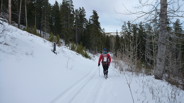
Following the ATV trail towards the skyline ridge we planed to ascend

Postholing up the south slope to our right after about 1 km on the ATV trail

Navigating our way through standing and fallen burned timber in calf-to-knee-deep snow

More left/west we went, less snow we encountered

Dead timber along the way up

Looking back down the ATV trail and our car

Hiking towards the rock band

At the base of the rock band that guards the summit ridge

Going up a weakness covered with snow and ice which changed an easy scramble to a more like moderate one

Looking down

Going up the second tier of the rock band

Easier than the first one

The last bit up to the ridge

A scenic ridge walk all the way to the summit


Standing on the top of Hillcrest Mtn by the summit cairn

Prairie views to the east

View S-SE along the south ridge

The mountains to the SW were all covered by clouds

View W-SW over (f-b) Hearts Peak (foreground) and Hastings Ridge (mid ground) to the Flathead Range

View W-NW over (f-b) Hearts Peak (foreground), Hastings Ridge (mid ground left) and Willoughby Ridge(far right) to the Flathead Range

Mt Darrah to the left

l-r: Mt Coulthard(2nd CL), Andy Good Peak(CL), Mt Parrish(C), Chinook Peak(CR), Mount Mclaren, and Sentry Mountain towering above Willoughby Ridge(M,R) to the northwest

Looking NW towards Crowsnest Mtn(L) and Seven Sisters Mtn(L) with Gould Dome and Tornado Mtn rising beyond Ma Butt to the right

Turtle Mtn to the north with Livingstone Range to its right

Livingstone Range to the NE. Centre Peak is the highest peak

Looking SE down to the tiny peak of Mt Backus with (l-r) Prairie Bluff, Chief Mtn(dark shade), Drywood Mtn, Victoria Peak(CR) forming the backdrop

Mt Gladstone beyond Table Mtn to the left, Whistle Mtn to the right

Mt Darrah(L) to the SW

Willoughby Ridge in the foreground with Mt McLaren beyond to the NW

Crowsnest Mtn getting mysterious

Gould Dome(CL) and Tornado(C) towering above Ma Butte(CL,F) and McGillivray Ridge(R,F) to the north slightly by west

The adjacent Turtle Mtn directly to the north

Centre Peak to the north by east

The beautiful northern view

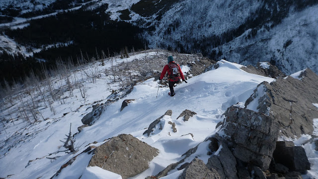
Going down the way we came

Approaching the rock band

Downclimbing the rock band

Looking up

The cloud had lifted to reveal the mountains to the SE including (b/g,l-r) Prairie Bluff, Drywood Mtn, Victoria Peak(CL), Table Mtn, Mt Gladstone, Windsor Mtn and Castle Peak(R)

Descending the steep slope

The snow speeded our descent

Back to the ATV trail

Going right when the trail forks

Back to the trailhead

The end.

No comments:
Post a Comment