Saturday,
12/22/2018, Mt Mann – Hwy541, Highwood Area, Kananaskis, AB
· Round Trip 8.4km;
Elevation: 1915m; Elevation Gain: 450m; Time: RT - 4:35hrs (10:10-14:45),
ascent - 2:40hrs, descent - 1:45hrs; easy to moderate scramble on ascent, easy
hike on descent.
· Books: ‘Gillean
Daffern’s Kananaskis Country Trail Guide—Volume 5’ by Gillean Daffern
References:
· 50.3856N -114.599W, Located in the
Highwood River Valley at Highwood Gap, Province: Alberta, Park: Kananaskis,
Headwater: Bow, Major Valley: Highwood, Visible from Highway: 541. (from peakfinder.com)
Drive
From Calgary, drive south on Hwy 2/Deerfoot
Trail, take the exit for Okotoks driving south on Hwy2A, passing through
Okotoks, for 10.9km, turn right/west onto Hwy7 towards Black Diamond and drive
for 19.3km, turn left driving south on Hwy22 for 17km to Longview, and then
turn right and drive west on Hwy541 for 37.9km, park on left side of the road.
Driving time would be around 1.5 hours.
On foot
Mt Mann is always in the bottom of our to-do list for its small and lack
of views, plus the river crossing over Highwood River. Unwisely, we chose to
challenge her on a rather cold day.
When we arrived at
the parking spot, the wind was howling which made it at least 5 degree colder
and made us hesitate. Before crossing Highwood River wearing a pair of old
boots, we walked along the river for a while and found a shallower spot to
cross it. The water was icy cold and the current was strong enough to hinder us
from going fast. Once got out of the water, we dried ourselves off with a towel
immediately, and then hid behind trees to put on our thermal underpants, socks
and hiking boots. After hiding the wet boots, we started our hike towards Mt
Mann by following the trail along the right/west side of Cataract Creek which
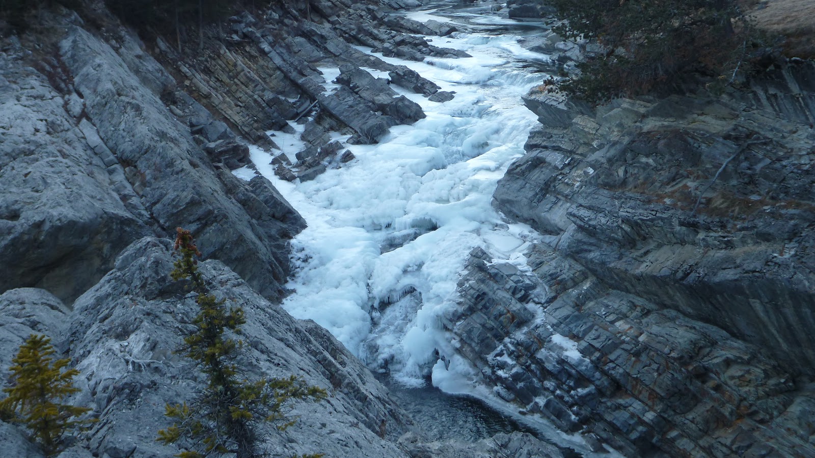
became the highlights of the trip for its beautiful gorges and frozen cascades.
About 2 km from
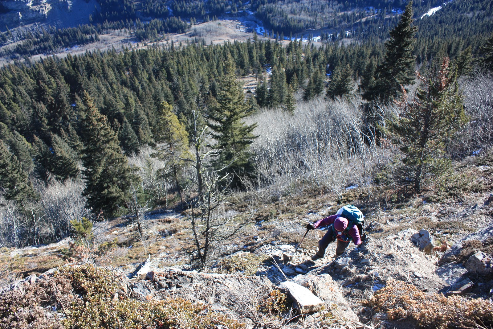
the parking, we opted for the more direct route up the ridge by ascending the
steep slope to our right/west. There was no trail up this treed slope, and because
of its steepness, sometimes we had to grab the trees to pull our bodies up.
Just before the ridge proper, we needed to climb up a rock band through a
weakness involving some easy to moderate scrambles and minor exposure. After
that, it was an easy navigation through thin trees along the ridge to the
summit of Mt Mann.
The summit itself
and the views from it were hardly impressive since the trees blocked most of
the vision except the one to the east. So, we didn’t linger, but went down
while eating our lunch.
On the way down,
we didn’t descend the steep slope we came up, instead, we kept following the
ridge south for 700 metres more and then turned left headed east-northeast on a
snow-covered faint trail. When this trail cut our ascent slope, we simply
bushwhacked back to the main trail and followed it back to the Highwood River. To
our surprise, the old boots we used to cross the river this morning was frozen and
rock hard and impossible to set our feet in. We then had to wet the hiking boot
we were wearing. Fortunately, the water was much warmer now than in the morning
and our car was nearby.
To be honest, this
is an outing that we wouldn’t want to
repeat, especially in a cold day.

Crossing Highwood River

Following the trail along the right/west side of Cataract Creek

Cataract Creek became the highlights of our trip for its beautiful gorges and frozen cascades

Keep walking through aspens

About 2 km from the parking, we opted for the more direct route up the ridge by ascending the steep slope to our right/west

There was no trail up this treed slope, and because of its steepness, sometimes we had to grab the trees to pull our bodies up

Climbing up a rock band through a weakness involving some easy to moderate scrambles and minor exposure

Looking down the weakness
Working my way up the ridge

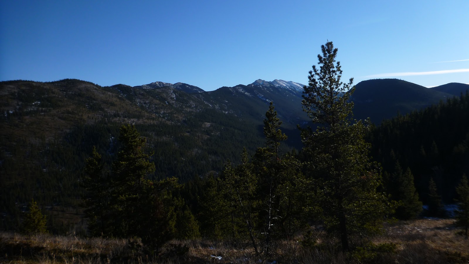
Looking SE towards Zephyr Creek Hills(CL) and Mt Burke(R) from the ridge

A close-up of Mt Burke

Zooming in on Mt Etherington(L), Baril Peak(CR), and Mt Cornwell(2nd R)

Easy navigation through thin trees along the ridge to the summit of Mt Mann

Standing on the so-called summit of Mt Mann

Bull Creek Hills to the NE

Looking east along Hwy 541 towards Eden Valley

Zephyr Creek Hills(C) and Mt Burke(R) in the b/g to the SE

Looking North at Holy Cross Mtn through trees

Highwood River parallels Hwy 541

Going down

Little views on the way down

Baril Peak(L), Mt Cornwell(CL), and Courcelette Peak(CR) to the SW on the way down

Mt Armstrong(C) and Mt Maclaren(R) to the SW

Peaks in High Rock Range above Hell's Ridge forming the backdrop

Mt Burke(CR) and Plateau Mtn(R,flat)

Limited sight of peaks to the NW

slim trees

Mt Burke from the lower ridge

About to turn left

Last glimpse of Mt Burke
Heading east-northeast on a snow-covered faint trail

Back on the main trail

Long casting shadow

Mt Mann from the trail

Admiring Cataract Creek again on the way out


Beautiful Gorge

Crossing the Highwood River once more

The end.
No comments:
Post a Comment