Sunday, 7/01/2018,
Kananaskis Peak — HWY40, Elbow-Sheep Wildland PP, Kananaskis, AB
· Round Trip: 8.5km;
Elevation: 2419m; Elevation Gain: 980m; Time: RT – 7:35hrs (8:25-16:00), ascent
– 4:10hrs, descent – 2:30hrs; Moderate scramble with steep slope and a short
but narrow ridge right before the summit
References:
Drive
From Calgary, drive
west on Hwy 1 for about 60km and take exit 118, then head south on Hwy 40 for
about 23km, park on the left side of the road. Driving time would be around 50 minutes.
Hike
Kananaskis Peak is the unofficial name for the high point of
the north end of the Mt McDougall massif. It is a small peak but not an easy one
for me. I even had difficulty to understand the route up and the true summit because
of the inconsistencies between the route on the map and the description from
others’ trail reports. So we started our adventure with some doubt to be
figured out.
From the roadside parking, we
headed northeast on a dry creek bed first and picked up the trail leading to
Wasootch Peak soon. Within 10 minutes from the trailhead, we saw some single trails
on our right leading down to the creek. So we checked the GPS track, and it
suggests that the turnoff was still ahead. Even though I highly suspected it, I
still chose to follow the GPS since I wanted to stay on the trail as long as
possible, in other words, I would try everything to postpone the bushwhacking. However,
we soon had to backtrack from where the GPS suggests the turnoff since there
was no way for us to get down the cliff wall on our right without breaking our
legs, worse luck.
So we quickly backtracked about 280
meters and found a weakness to get down to the left/north side of the creek,
and then bushwhacked on a game trail heading east. After spending a couple
minutes playing with the waterfall, we continued hiking through trees to the second
drainage that took us to a steep slope full of loose rock. We did our best to
stay on solid rocks and slabs, but the steepness of the slope really tired me
out especially the last bit to the ridge. Upon reaching the ridge, we turned
left and found a gendarme blocking our way. So we made a detour to its right
and regained the ridge by ascending a scree slope only to be blocked by another
gendarme. We then made another detour losing and gaining more elevation, and
eventually got back to the ridge and had some real scramble fun by climbing an
almost vertical rock wall with good holds. After that, the route ahead revealed
completely and the ridge walk should be more pleasant if only the wind could be
less strong. When we stood on a high point where three ridges intersect, we thought
it is the summit of Kananaskis Peak because the map says so. However, another
high point across the col to the northeast looked as high as us, so we decided
to tackled that one as well after a short stay. We were so glad we made this
decision as this high point is the true summit of Kananaskis Peak which
approved by the register on the top and others’ trail reports. From the col, it
is a 10 minutes climb to the true summit involving a narrow and exposed section
well before the summit.
Even though it wasn’t windy on the true
summit, we still couldn’t stay long for the coming storm. We backtracked to the
col, and then utilized the orange scree for quicker descent. Once on the creek,
it started to rain and I started to feel pains on my right knee every step I walked,
so our hike out became slow and tough. By the time we came back to the car, we were
all soaked, but at least we bagged a peak.

From the roadside parking, we headed northeast on a dry creek bed. Cairn and rock arrow indicate the trail for us to follow.

Looking back at Mt Kidd under a sunny sky

Within 10 minutes from the trailhead, we should have dropped down to the creek on our right instead of continuing up on the trail

Bushwhacking on a game trail heading east along the left/north side of the creek

Spending a couple of minutes playing with the waterfall

An interesting view through the water fall

Continue hiking through trees and the dry creek bed

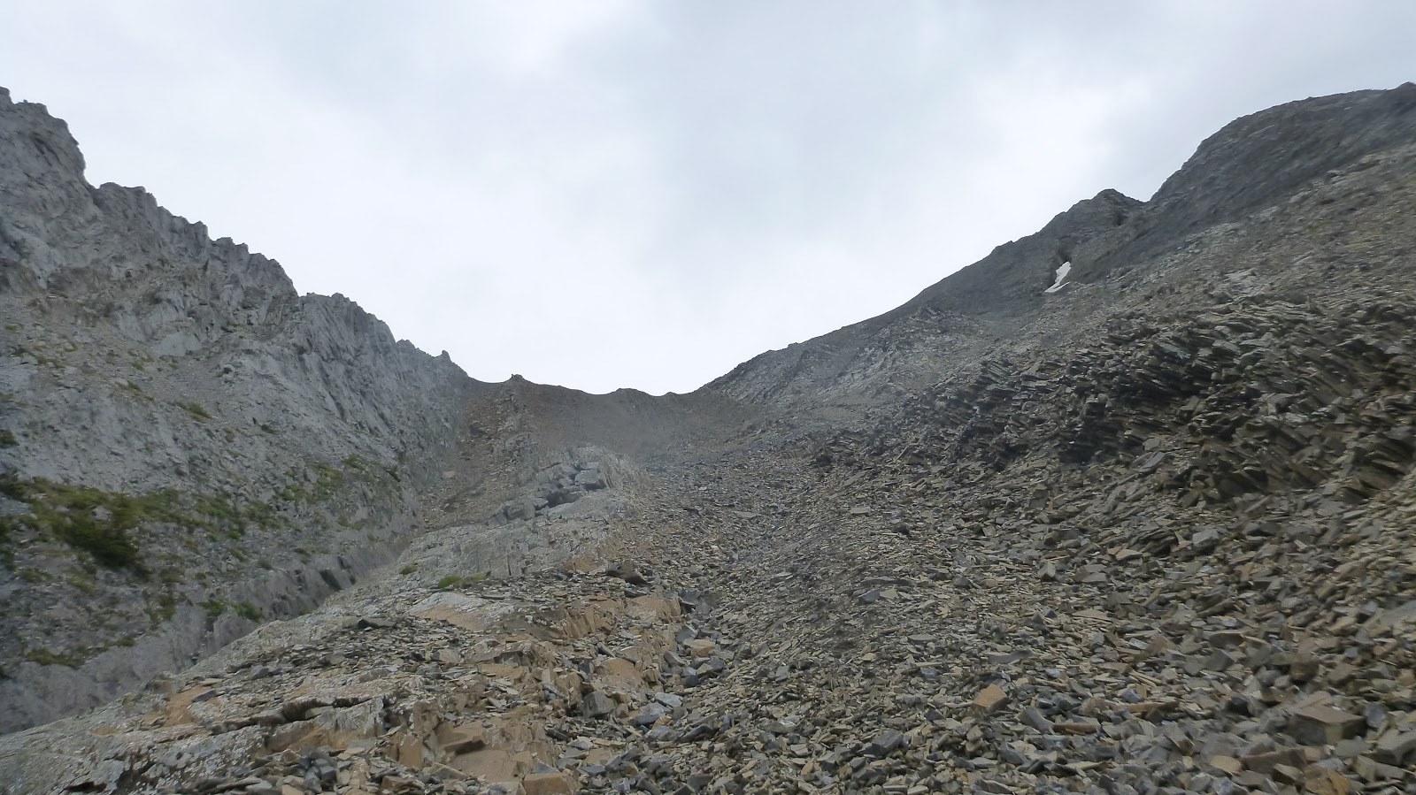
The second drainage would take us to a steep slope full of loose rock

Gua mainly stayed in or close to the drainage

Trying the best to stay on solid rocks and slabs. The slope is much steeper than it looks in the picture below

The last bit to the ridge

Upon reaching the ridge, we turned left and found a gendarme blocking our way

Making a detour to the right

Eventually got back to the ridge and had some real scramble fun by climbing an almost vertical rock wall with good holds

Looking down

Scrambling a last step

The view opens up

The route ahead reveals completely

Looking back with Nakiska Ski Area in the b/g

The ridge narrows a bit in places

Looking at the true summit from the false summit

Views from the top of false summit


Heading to the true summit

A narrow and exposed section well before the summit

Looking back at this narrow and exposed section

Standing on the top of Kananaskis Peak

Summit views


A closer look at Mt Lorette and Skogan Peak(B)

Yates Mtn(CL) and Mt Baldy(R) to the north-northeast

Midnight(CL) and Midday(CR) Peaks to the northeast

Boundary(L) and Tiara(R) Peaks to the east-northeast

View east with Wasootch Peak in the f/g

Getting down

Scree running down

Looking back to the col
Down to the creek

Looking up the ascent gully on the way back

The dead fall encountered on the way out

Looking up for views

The way out


Back on the trail

By the time we came back to the car, we were all soaked, but at least we bagged a peak.

The end.
No comments:
Post a Comment