Saturday, 04/28/2018,
Hell’s Ridge – Hwy940, Highwood Area, Kananaskis,
AB
· Round Trip: 10.4km(A loop);
Elevation: 2046m; Elevation Gain: 392m; Time: RT – 7:05hrs (9:30-16:35), ascent
– 2:00hrs, descent – 4:15hrs; A mixed snowshoe and boot trip with no avalanche
risk
· Book: “Gillean Daffern’s
Kananaskis Country Trail Guide—Volume 5” by Gillean Daffern
References:
Drive
From Calgary, drive
south on Hwy 2 / Deerfoot Trail, take the exit for Okotoks driving south on
Hwy2A for 10.9km, turn right/west onto Hwy 7 towards Black Diamond. From Black
Diamond, drive south on Hwy 22 to Longview and then turn right/west onto Hwy
541 for 43.1km to Highwood Junction, turn left onto Hwy 940 for 5.8 km to the turnoff
to Etherington Creek Campground, park on
the opposite side of the turnoff.
Driving time would be around 1:50 hours.
Hike
We didn’t want to spend another weekend sitting on the couch
and watching a lot of meaningless TV shows anymore, so we went through some
potential objects and settled on Hell’s Ridge to avoid any avalanche risk.
One of the trail reports I read on
the internet suggested that it might be one of the most miserable days one would
have had in the mountains if he has to wade through deep snow along the bumpy
ridge – as was the case for us. So, we did have a miserable day, but not only
because the deep snow on the treed ridge, but also for the entire isothermal
snowpack on the slope we ascended and the Etherington Creek Trail on our way
back.
Considering the snow volume we
might encounter on the ridge, we decided to head to the summit first, and then
try the ridge towards the north end to make a loop counterclockwise if the snow
is manageable. If not, we would forgo the plan of making a loop, but at least claim
the summit per se.
From the parking, we firstly set
out just wearing our boots, but were soon forced to retreat by the unsupportive
knee-deep snow. We then put on our snowshoes and restarted our ascent on the slope
directly to the east of the parking spot. The entire ascent was in the woods
and the unsupportive snow and bush slowed down our progress. Just before the
summit ridge, the grade of the slope increases dramatically, and the snow
disappeared. Wearing snowshoes on such condition was a bit uneasy, but
fortunately, it was short and still controllable. Once on the ridge, we walked
northward for a short distance to the true summit with one open side and
without any signs to show it is the highest point except consulting the GPS.
The weather was so nice and warm
that we took our time to finish our lunch, and then followed the ridge north. It
wasn’t a pleasant open ridge walk, but in contrast, it was an undesirable
snowshoeing on undulated ridge with trees, shrubs, rocks and deep snow. We
eventually removed our snowshoes to safely walk through some narrow and rocky
section. We originally planned to descend from the north end of the ridge but
somehow forgot it or just had enough of this boring walk and ended up left the
ridge well before the bump at the north end. We descended the steep grassy
slope west towards the Etherington Creek Trail thinking a good walk on a broad
trail back to the car was waiting for us. However, since we didn’t bother to
switch to our snowshoes, the half-melted packed trail with uneven surface gave
us a really hard time. Unfortunately, our trip was concluded by our sudden slipping
and sinking into the soft snow once in a while and did make us believe that we
went to hell and back.

Roadside parking and trailhead

Ascended the slope directly to the east of the parking spot instead of following the Etherington Creek Trail

The unsupportive snow and bush slowed down the progress

The last bit to the summit ridge was quite steep and snow free

Looking at the treed summit

View south-southwest from the summit of Hell's Ridge

Looking southwest to Raspberry Ridge(L) and Etherington-Baril Ridge(R) with (l-r) Mounts Farquhar, Holcroft, Scrimger(C), Etherington(CR), and Baril Peak in the background

View west

Northwest

An intruder

The ridge stretches for a long distance to the south

Raspberry Ridge

Baril Peak to the SW

Mt Armstrong(C) and Mt Maclaren(R) to the northwest
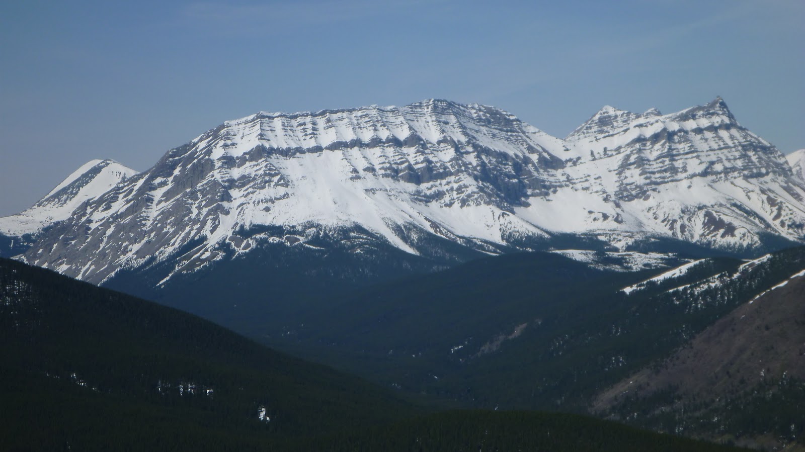
Looking NW beyond Strawberry Hills towards (l-r) Mounts Strachan, Muir, McPhail(CL), and Horned Mtn(CR) and Mt Bishop

A closer look at Mt Bishop(L)

Following the ridge north. Apparently, it wasn't a pleasant open ridge walk.

A look at Mt Head(CR) and Holy Cross Mtn(R) to the north

Getting around a patch of snow

A rocky section of the ridge

Our last high point ahead

Got a look at the long ridge of Mt Burke to the SE

A view to the east

Before the bump at the north end, we decided to descend the steep grassy slope to our left

Descending the steep grassy slope west towards the Etherington Creek Trail

The half-melted packed snow on the broad Etherington Creek Trail really gave us a hard time

The end.
No comments:
Post a Comment