Saturday,
1/20/2018, Three Lakes Valley – Hwy 742/Smith-Dorrien, PLPP, Kananaskis, AB
· Round Trip: 12.5km;
Elevation: 2465m; Elevation Gain: 555m; Time: RT – 4:55hrs (9:35-14:30), ascent
– 2:40hrs, descent – 1:40hrs; An easy snowshoeing trip
References:
http://forums.clubtread.com/130-canadian-rockies/42938-chester-lake-three-lakes-valley-sept-1-a.html
Drive
From Calgary, drive west on Hwy
1 for about 60km and take exit 118, then head south on Hwy 40 for about 50km to
the Kananaskis Lakes Trail turnoff. Turn right and drive
2.2 km to the Smith Dorrien Trail/Hwy742 - Kananaskis Lakes Trail junction. Turn right onto
Hwy742 for another 20.1 km and park at Chester Lake parking lot on your right. Driving time would be around
1:40 hours.
Hike
Giving the unstable
weather and high avalanche forecast, it was difficult to find a suitable object
and/or enough motivation for hiking. However, when I mentioned Three Lakes Valley
Trail I came across from Nugara’s website, Gua quickly picked this trail as our
hike for the weekend.
The snowshoe trail to Chester Lake was well signed and packed, thus easy
to be followed. It was slightly snowing when we left the parking and the trail
was quite quiet that may have something to do with the weather, I guessed.
However, we encountered at least 30 parties on our way out at the end of the
day even though it had been snowing the whole day long.
Upon arriving at the Chester Lake, we turned left/NW onto a narrower
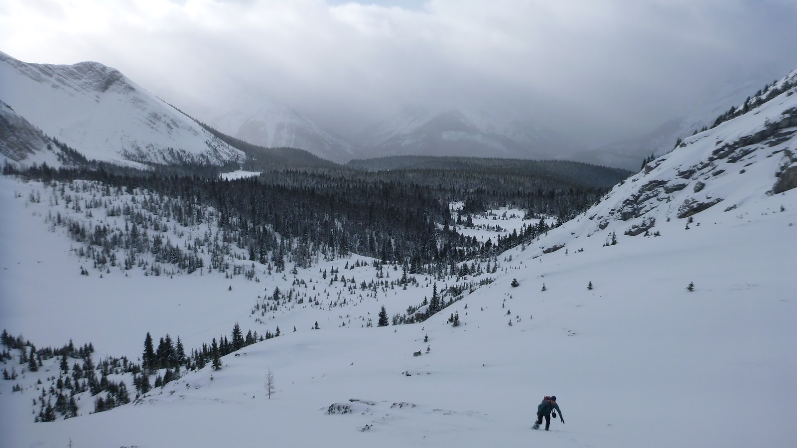
trail and quickly passed through the Elephant Rock. We soon came out of the trees
and stepped into a beautiful valley between Mt Galatea and Gusty Peak. From now
on, we hiked northeastward on a much softer ski/snowshoe track. We might not
need snowshoes before, but did need it after this point. The track right
stopped at the first lake, so we had to break trail on our own when we walked
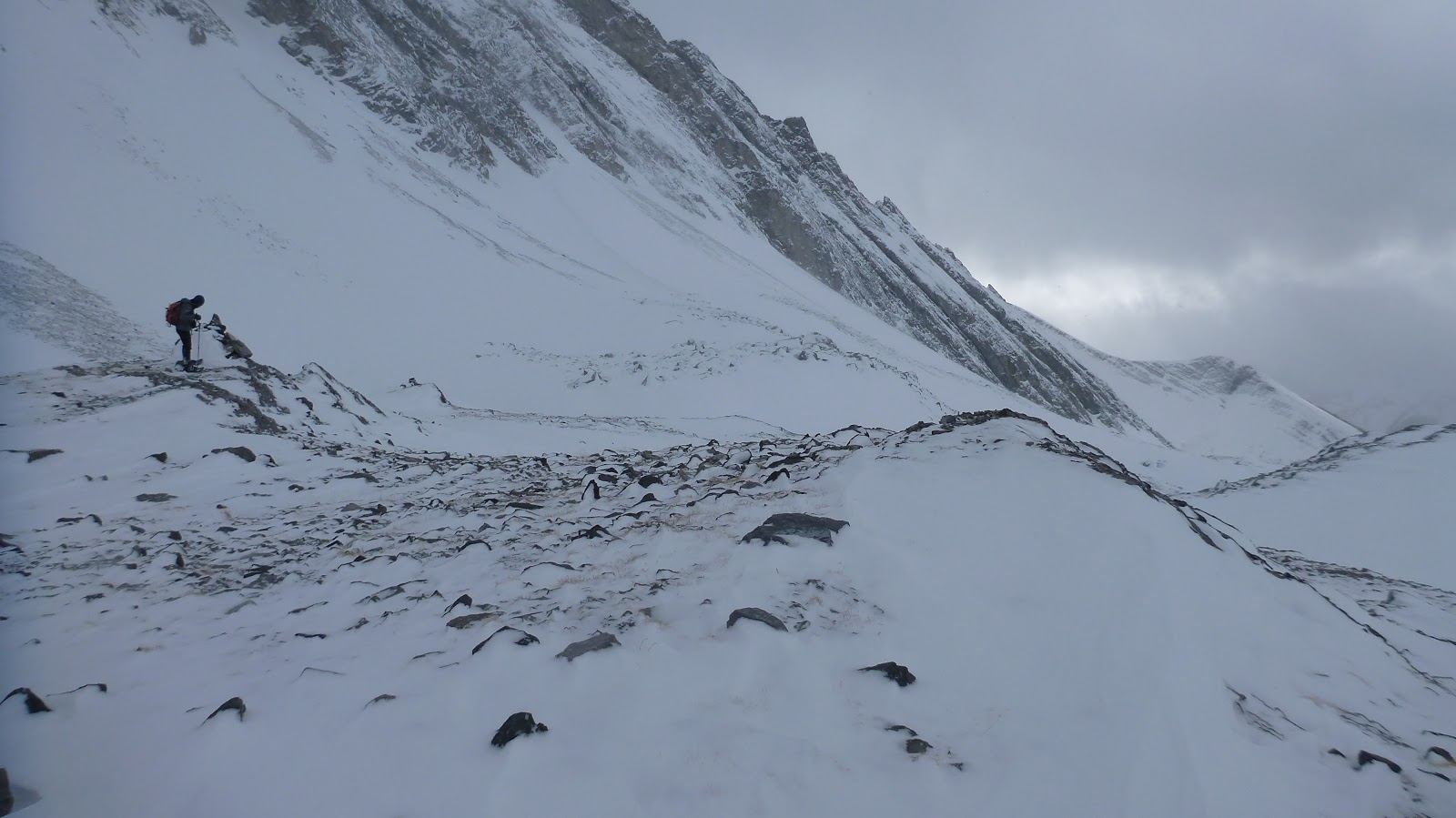
further in to the valley. Fortunately, the steep slope and deep-snow section
was rather short, and we mostly traveled on flat terrain and shallow snow. However,
as we went deeper, the wind picked up more and more and became really cold
especially at our destination at where there were two cairns. The blowing wind
and snow was unbearable, so we left the cairns and went a bit further hoping the
wind would settle a bit. But it didn’t, so we stopped just before the third
lake according to our GPS, and went back right away to escape the wind and
cold.
After coming back to the first lake, I could finally feel my face again,
so we slowed down a bit and noticed some skiers were having fun in the area. As
I said before, we saw many parties coming and leaving when we walked back down to
the parking lot from the Chester Lake even though the sky was still grey. Therefore,
just going to Chester Lake would not be a good idea if you want more solitude. However,
going further and deeper like us did may well satisfy you, since we didn’t see
a single soul after the first lake whatever on our way in or out.

The trailhead of Chester Lake Trail

Looking back across the parking lot

Crossing the opening with Mt Galatea(L) and Gusty Peak(R) ahead

Mt Chester above Chester Lake

Snow-covered Chester Lake below Mt Chester

Passing through the Elephant Rock

Coming out of the trees and stepping into a beautiful valley between Mt Galatea and Gusty Peak


Hiking northeastward on a much softer ski/snowshoe track

The route we took from the first lake

Ascending the steepest terrain in this valley. The picture doesn't do its justice

Almost to the top of the steep slope

Looking back from the top of the slope with the first lake on bottom left
Going deeper in to the valley

Looking back at the footprints before it vanished

The wind howled around our destination

Looking back
Mt Galatea's ascent gully

Stopping in front of the third lake

Escaping the blowing snow and cold

The wind wiped off our footprints already

Above the first lake

Going back to the Elephant Rock with Mt Chester in the background

The cloud lifted a bit

Gusty Peak

Following the trail back to the car

The end.
No comments:
Post a Comment