Sunday, 11/26/2017, Cat Creek Knob – Hwy40 E, Highwood Area, Kananaskis, AB
· Round Trip: 12km;
Elevation: 2350m; Elevation Gain: 780m; Time: RT – 6:40hrs (9:30-16:10), ascent
– 3:50hrs, descent – 2:15hrs; A very steep hike with some creek crossing, route
finding and bushwhacking
· Book: ‘Gillean
Daffern’s Kananaskis Country Trail Guide—Volume 5’ by Gillean Daffern
References:
Drive
From Calgary, drive south on Hwy 2/Deerfoot Trail, take the exit for Okotoks driving south on Hwy2A for 10.9km, turn right/west onto Hwy 7 towards Black Diamond. From Black Diamond, drive south on Hwy 22 to Longview and then turn right/west onto Hwy 541 for 43.1km to Highwood Junction, continue driving north on Hwy 40 for 5.5km, just before the Cat Creek bridge, turn right into a flat, park beside the logging road. Driving time would be around 1:40 hours.
Hike
We would like to visit an area that will soon become inaccessible due to the Annual Road Closures start from December. We figured that the south Highwood may have less snow, so we picked Cat Creek Knob trail described by Bob Spirko on his website. Originally, the higher Cat Creek Ridge was more attractive to us, but would take over 9 hours. We had to save it for other time, but still felt happy to do a 2350m peak in the end of November. This small knob was unnamed and little-known which was approved by the result of my research on the internet. Except Bob, Andrew Nugara is the other one who had visited this knob and posted a trail report online, though the guide book has some trail descriptions about this area.
From the parking, we left the snowshoes in the car and walked along the dry logging road for a couple minutes until it heads north and our object appeared ahead. We then turned right here and followed a shortcut to the upper logging road. We knew this is an exploring trip because of the lack of information, yet we had never known there would be so many trails to be chosen in the area. Even though we preferred the wide logging road, we chose a single trail that runs along the east side of Cat Creek since we didn’t know to where the logging road would eventually lead. It went well at the beginning, but we then ended up losing the trail in the snow covering forest and following some sort of animal trails down to a dead end above the creek. Without other choice, we then bushwhacked up the hill on our right and headed north. In a short time, we, surprisingly, stepped onto a haul road that brought us to a fork. We stayed on the haul road going straight/north until we arrived at the base of our target. Here we turned right and bushwhacked on the right/south side of a stream lying at the foot of Cat Creek Knob for 30 minutes, and then crossed the stream easily and started our ascent on southwest rib of Cat Creek Knob. This rib had a thin lay of snow here and there, and the angle is high enough to quickly drain our energy. We could only relax until we reached the southeast ridge that connects to the summit. Despite the fact that we encountered knee-deep snow, the ridge walk was short and pleasant comparing to the steep slope we just climbed.
It was very windy on the top of Cat Creek Knob, and the most disappointing thing was that cloudy sky. The grey cloud and mist blocked the views and limited our visibility. When it started to drizzle, we left without hesitation and returned the same way we came.
My track

Trailhead on logging road

Walking along the dry logging road for a couple minutes until it heads north and our object appeared ahead. We then turned right here and followed a shortcut to the upper logging road.

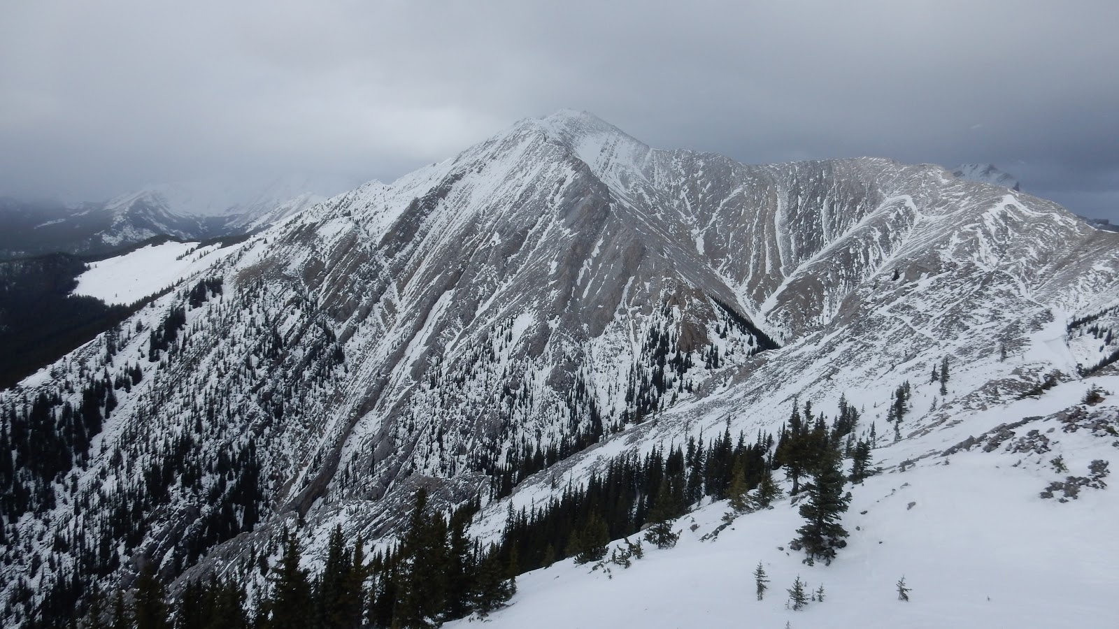
Cat Creek Knob. Our ascent route is the ridge to the right

Shortcutting

Leaving the wider logging road here

The trail that runs along the east side of Cat Creek went well at the beginning

Bushwhacking up the hill on our right when we lost the trail and down to a dead end above the creek

On a haul road

The haul road brought us to a fork

Easy creek crossing

We unnecessarily crossed the creek here. Red line is the correct route

The road becomes narrower from now on

Arriving at the base of our target. Here we turned right and bushwhacked on the right/south side of a stream lying at the foot of Cat Creek Knob for 30 minutes

After crossing the stream easily we started our ascent on southwest rib of Cat Creek Knob

The view to the south and west on the way up the ridge crest

Approaching the southeast ridge

The final trudge up the ridge crest

The southeast ridge connects to the summit

Despite the fact that we encountered knee-deep snow, the ridge walk was short and pleasant comparing to the steep slope we just climbed

Heading to the summit

Standing on the summit of Cat Creek Knob

View east with Mt Head in the centre and Holy Cross Mtn to the right

A blurry view to the south

Serendipity Peak(C) to the north
The much higher Cat Creek Ridge(CR)

A close-up of Mt Head(L)

and Holy Cross Mtn(L)

Mt Burke in the distant left(with some imagination), Stony Ridge on the near left and Junction Hills to the right of centre

Panorama from Serendipity Peak(N/L) to Holy Cross Mtn(SE/R)

Heading down

Back to where we started the steep climb

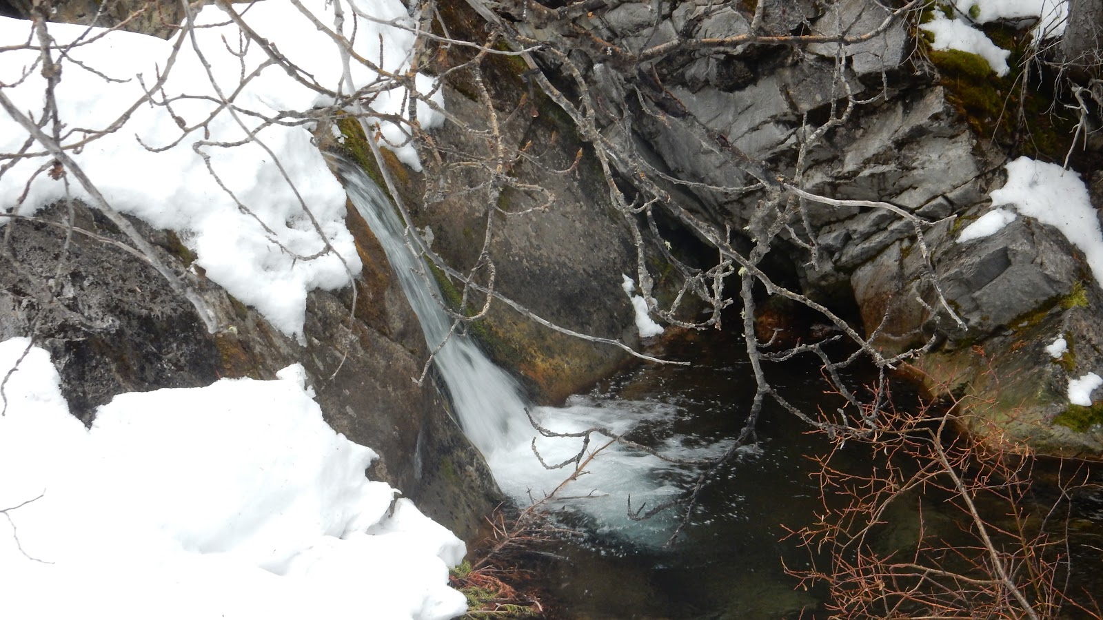
A cascade falling over a small cliff
We didn't use this part of the road on our ascent

We turned left down the hill here to rejoin the logging road we used on ascent

going down the hill

Back to the trailhead

The end
No comments:
Post a Comment