TRIP 186
Friday, 7/01/2016, Wastach Mountain — Moraine Lake, near Lake Louise, Banff
NP, AB
· Round Trip 14.2km;
Elevation: 2844m; Elevation Gain: 990m;
Time: 4-6hrs, ascent time: 2-3hrs; Easy scramble, mostly a hike with great reward
Thanks to the
following TR:
· Located between Moraine Lake Valley and
Paradise Creek Valley, 1.3 km west of Eiffel Peak. Banff Park, Alberta. Latitude
51; 19; 50 Longitude 116; 15; 01, Topo map 82N/08. Can be seen from Highway 1.
车行路线:从 Calgary 西北出发,沿着北段 stony trail 向西行驶,然后在 Exit 36离开向右拐上 Hwy1西行约167km,由 Lake Louise 出口离开向左拐上 Lake Louise Dr 前行2.5km
(约5分钟) 后向左拐上 Moraine Lake Rd 前行约12km 到达 Moraine
Lake 停车场。起点在停车场尽头。
步行路线:9:30am 前到达停车场时已游人如织,不过与金松季节相比还相差甚远,且仍有不少停车位。
9:30am 出发在几人宽的 Larch Valley Trail 上走了40分钟便向左拐上窄小许多的 Eiffel Lake 路径。沿着盘于山腰间的小道往西行走的途中会不自觉地为 Valley of the Ten Peaks 的美景驻足。形态各异的十座山峰和她们怀里的山谷湖泊深深吸引着一拔又一拔的游人,因此感觉这条小道有些拥挤,也有些过于热闹了。而我们在此道上走了50分钟约1.3km 后便离开了人群,从右面的山沟往上爬。爬上 Wastach 与 Eiffel 之间的山坳后我们稍作停留,然后从左面的山坡往上爬。开始的泥石坡虽然陡,但没什么困难。之后的大石头坡让人有些不知从何下手的感觉,我最终选择从大片积雪的左边往上爬,LG 则从其右边往上爬,好像我走的路线相对平坦一些,最后也先一步于12:35pm 登上了 Wastach Mountain 的山顶。
山上风景优美,可惜天气并未能跳脱于预报之外,原本蔚蓝的天空在午后便如期被云层完全遮盖。好在是高云,并不影响看山,但少了蓝天白云的衬托,山景自然逊色了一点。由于气温宜人,我们得以在独霸的山头玩耍了一个多小时,尽兴后于2:12pm 原路下山,并于4:20pm 回到了停车场。
总结:
· 上山用时3小时05分,下山用时2小时08分,在山顶停留1小时37分钟,全程用时6小时50分。
· 轻松短易的路线,人迹罕至,却不乏美景,性价比甚高,强力推荐,唯一不足是运动量不够。
My Route

Moraine Lake 已聚集了不少游客

在几人宽的 Larch Valley Trail 上走了40分钟

然后向左拐上窄小许多的 Eiffel Lake 路径

沿着盘于山腰间的小道往西行走的途中会不自觉地为Valley of the Ten Peaks 的美景驻足

走至左下角的 Eiffel Lake 的上方后不久便到了离开官道的地方

离开官道后从这条山沟两旁的草坡往上爬

从山沟往下看,底下的 Eiffel Lake 变成了蓝色

爬上 Wastach 与 Eiffel (下图) 之间的山坳后我们稍作停留

然后从左面的山坡爬向 Wastach Mtn(下图)。开始的泥石坡虽然陡,但没什么困难。之后的大石头坡让人有些不知从何下脚的感觉,最终两人分别选择了从大片积雪的左右两边往上爬。

Eiffel Lake 里朦胧的山影

至爱的 Deltaform Mtn(L)
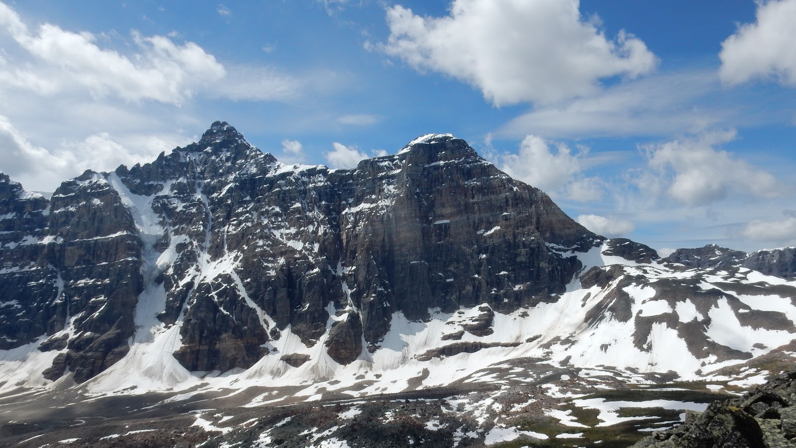
这是让人不知从何下脚的大石头坡

向山顶接近

Looking back at (back to front) Mt Temple, Pinnacle Mtn, and Eiffel Peak

Summiting

Mt Temple, Pinnacle Mtn, and Eiffel Peak to the northeast

Looking east at Eiffel Peak(L) with Mt Babel and Mt Fay to the right of centre in the background

The hikers and big cairn on the top of Eiffel Peak

Zooming in on the summit ridge of Mt Temple. With sharp eyes, one can see two hikers on the pics below


The route to Mt Temple seemed dry enough

Another look of Mt Temple

Paradise Valley below

Looking SE towards the Valley of the Ten Peaks

Some of the Ten Peaks

(l-r) Mt Tuzo, Deltaform Mtn, and Neptuak Mtn to the south in the Valley of the Ten Peaks

Looking southwest beyond Wenkchemna Pass

Hungabee Mountain to the west

Valley of the Ten Peaks

From left/west to right/northeast: Hungabee Mtn, Ringrose Peak, Glacier Peak, Mt Lefroy(CL), The Mitre(CR,low), Mt Aberdeen, Haddo Peak, Sheol Mtn, and Mt Temple

View north. A big cave is noticeable on a close-up of The Mitre with Mt White sitting behind

Mt Aberdeen, Haddo Peak, and Sheol Mtn can be done together in a very long day

Zooming in on Mt Richardson, the highest peak in Skoki Area

Pika(L) and Ptarmigan(R) Peaks across Hwy1 in Skoki Area

Mt Richardson(L), Pika Peak and Ptarmigan(R) Peak

Fossil(C) and Redoubt(R) Mountains in Skoki

尽兴后原路下山

回望山顶方向。从身后的这块雪块滑下,既刺激又好玩

攀崖高手

走向山沟顶部

从碎石山沟下去

回到官道上

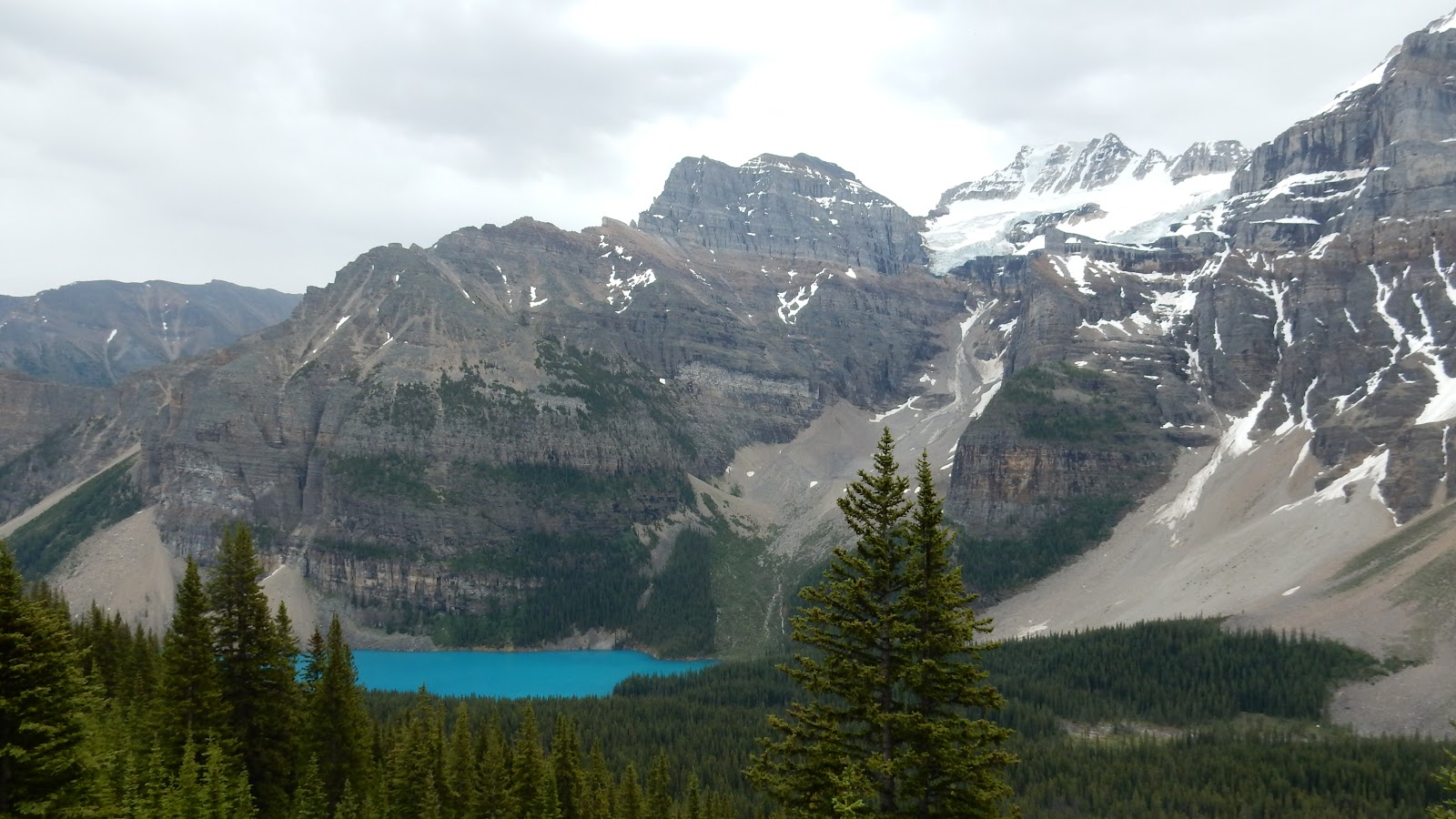
Moraine Lake 的颜色真美
回到起点

The end.
No comments:
Post a Comment