Saturday,
1/12/2019, Johnson Creek Ridge – Hwy532, near Indian Graves, South
Kananaskis, AB
· Round Trip 12km;
Elevation: 2024m; Elevation Gain: 554m; Time: RT - 4:55 hrs (09:45-14:40),
ascent - 2:35hrs, descent - 1:40hrs; Basically a steep hike
· Books: ‘Gillean
Daffern’s Kananaskis Country Trail Guide—Volume 5’ by Gillean Daffern
Drive
From Calgary, drive south on Hwy 2 / Deerfoot Trail
past High River. Turn right onto Hwy 540 and then turn left (south) onto Hwy 22
for about 14.3 km, turn right driving west on a gravel road of Hwy 532 for 12.1
km, park on the side of road. Driving time would be around 1:30 hours.
Hike
Because of the high avalanche risk, this
weekend, we still needed to stick to a much safer and dryer front country
object - Johnson Creek Ridge, a treed ridge that is located south of Johnson
Creek near Indian Graves Provincial Recreation Area where would have a favourable
forecast according to YR, a weather forecast website we consult largely.
Even though we
kicked off our day under a pretty grey sky, we were still in good spirits since
our main purpose of the day was getting out and having some workout; besides,
the sun might come out anytime. After hiking along the wide ATV trail southward
for about 1.1 km, we crossed a clearing and picked up the trail heading
west-southwest. At where the trail forks, we turned right/northwest crossing a
frozen small creek and soon arrived at another fork. This time, we took the
smaller trail on left directed by a ribbon tying on a branch. This smaller
trail had less snow and wound among slim trees. It brought us up a clearing
facing west-northwest with a view towards Hailstone Butt, Sentinel Peak, Mt
Burke, and Corral Creek Mtn. We followed the trail down about 500 metres and
then left it when it turns right/northwest. We hiked through thin tress
southwestward to the other side where we could see our object directly. From
there we skirted the deep valley on our right along the ridge southward first,
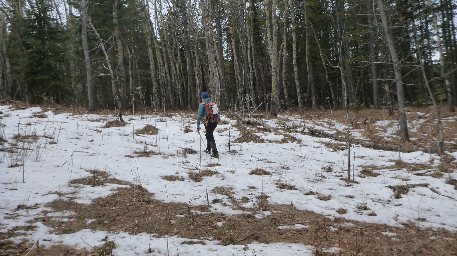
then dropped down to the valley bottom on our right and bushwhacked southwest
up the summit ridge, and then hiked south along the ridge all the way to the
highest point. Locating the highest point was a little difficult giving the
fact that it is a forest with no significant high point. So we kept hiking south
along the treed ridge visiting all potential high points until we came to an
opening that shows the ridge extending down to the south clearly. We stayed at
this opening admiring views to the southwest and west towards Saddle Mtn, Mt
Livingstone, Mt Hornecker, Windy Peak, and Hailstone Butt and taking our meal
break.
On descent, the cloud
did lift a bit and the sky brightened slightly, but the forecast sunshine didn’t
become the case. By mainly retracing our steps, except minor difference while
descending the slope to the northeast of the summit ridge, we went back to the
car uneventfully.

A moose from Hwy 532

Kicking off our hike along the wide ATV trail southward under a grey sky

Crossing a clearing and picking up the trail heading west-southwest about 1.1 km from the trailhead with the object on the skyline

Turning right/northwest and crossing a frozen small creek at where the trail forks

Soon taking the smaller trail on left at another fork

This smaller trail wound among slim trees and had less snow

Johnson Creek Ridge to our left

Hiking up

Arriving at a clearing facing west-northwest with a view towards Hailstone Butt, Sentinel Peak, Mt Burke, and Corral Creek Mtn

View NW across the valley to Highwood Area

Hailstone Butte to the west
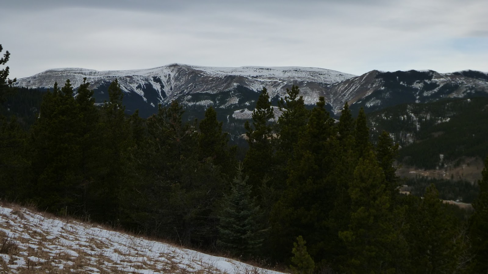
Iron Creek Mtn(C) and Sentinel Peak(R) in the b/g

Corral Creek Mtn

Mt Burke to the left of centre

l-r: Hailstone Butt, Iron Creek Mtn and Sentinel Peak

Following the trail (or cutline) down with Johnson Creek Ridge ahead

Leaving the trail when it turns right/northwest and hiking through thin tress southwestward to the other side
Skirting the deep valley between us and our object to our right along the ridge southward

Bushwhacking southwest up the summit ridge

Hiking south along the summit ridge

Quite difficult to locate the highest point

Sitting where we thought it is the highest point of Johnson Creek Ridge

Another high point

Looking south-southwest towards (l-r)Saddle Mtn, Mt Livingstone, Mt Hornecker, and Windy Peak from the opening along the ridge to the south

Saddle Mtn(L) and Mt Livingstone(CR)

Hailstone Butte to the west

On descent, the cloud did lift a bit and the sky brightened slightly, but the forecast sunshine didn’t become the case

Descending the slope to the northeast of the summit ridge

A cutline that we missed on ascent

Rejoining the way we came

Back on the ATV trail

Seeing the Indian Ridge means approaching the end of our hike

The end.
No comments:
Post a Comment