Sunday,
06/17/2018, Ochre Spring Peak – Hwy93S, Paint Pots Trailhead, Kootenay NP, BC
· Round Trip: 13km;
Elevation: 2780m; Elevation Gain: 1367m; Time: RT – 7:30hrs (9:55-17:25), ascent
– 3:55hrs, descent – 2:20hrs; Easy scramble with steep and loose gully and
slope that might need hands on
· Books: ‘Snowshoeing
in the Canadian Rockies’ by Andrew Nugara
References:
Drive
From Calgary, drive west on Hwy 1 for about 141km
and take the exit for Radium Hot Springs, turn left onto Hwy 93 south and drive
for about 19.7km, and then park at the Paint Pots Trailhead on the right/north
side of the road. Driving time would be around 1:50 hours.
Hike
Ochre Spring Peak is an unofficial name of
a peak lies between Tokumm Creek and Ochre Creek, and to the southwest of Mt
Whymper. It is in the 2nd edition of Nugara’s ‘Snowshoeing in the
Canadian Rockies’ now.
After being
stopped by a female park staff and spending a couple minutes on answering some
questions about our use of this park, we walked on Paint Pots Trail heading
west for about 3 km, and then ascended the avalanche gully on our right. Well
before reaching this gully, we saw fresh scat on the trail which panicked us
into pulling out our bear spray while bushwhacking the avalanche gully. We knew
there was no trial here, but didn’t expect this thick and high bush since no
trail reports mention about this. Fortunately, we found occasional faint trails
here and there, though it was short. Higher up, we started to encounter firm
snow where we saw fresh footprints leading up, so I guessed someone might be
ahead of us. This was approved later by seeing two figures slowly moving in the
upper gully. After the steep gully, we ascended the steep slope directly above
the gully while the other group traversed to the left and climbed up the snow
slope below the summit. The shale slope we took was pretty loose and steep and
giving us a hard time, but eventually we made it to the summit ridge without
incident. We then turned left heading to the summit to the northwest by walking
along the ridge and through a snow patch.
The summit view
was fantastic and the weather was warm and cozy. It would be a perfect day if
only we could have had the whole summit for ourselves. After taking a lot of
pictures, we got down the same way we came.

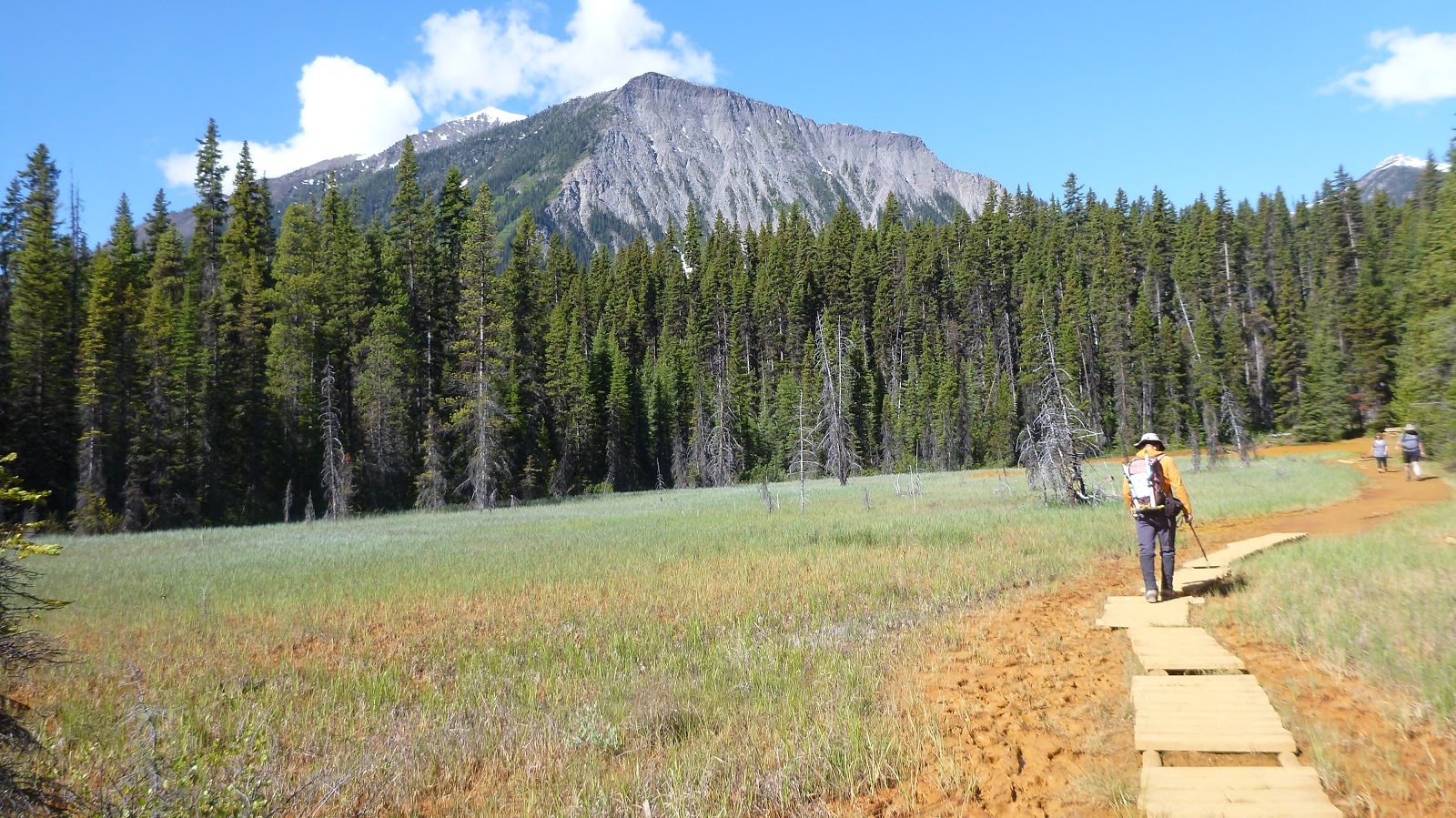
Walking on Paint Pots Trail heading west

Crossing Vermilion/Kootenay River

Ochre path

A beautiful open area
Seeing fresh scat on the trail well before reaching the avalanche gully panicked us into pulling out our bear spray

Left the trail here and ascend the avalanche gully on our right
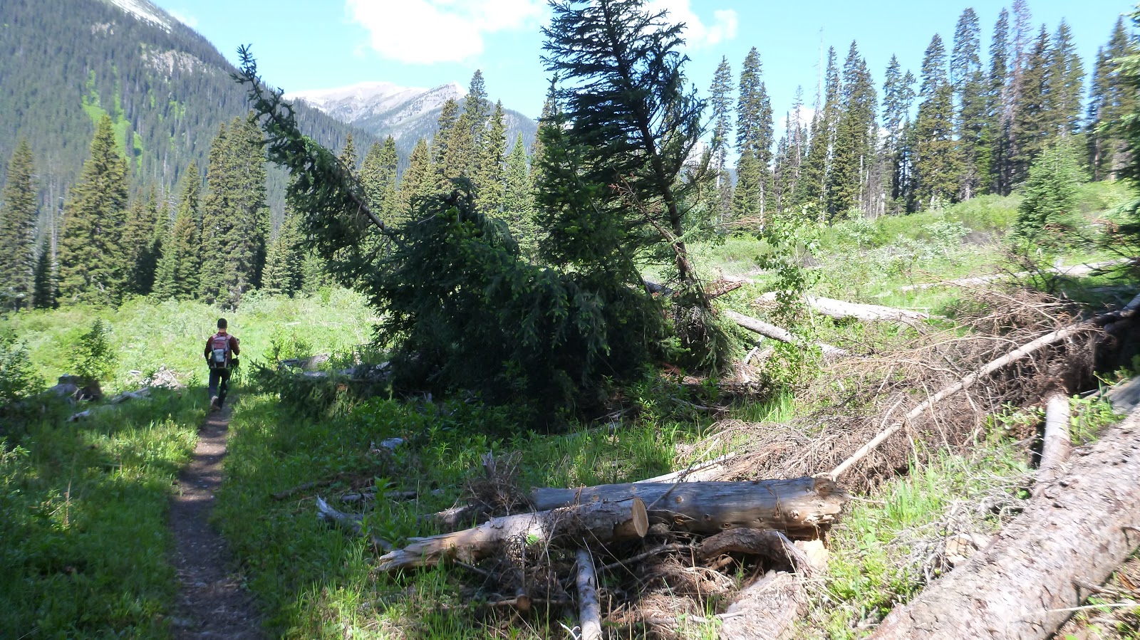
The avalanche gully With Ochre Spring Peak ahead

Thick and high bush in the avalanche gully

Start to encounter firm snow higher up

Ascending the steep slope directly above the steep gully while the other group traversed to the left and climbed up the snow slope below the summit

Looking up the ascent slope

Loose and steep shale slope giving us a hard time. In the red circle are the other party taking another route up

Topping out on the summit ridge without incident

Heading northwest to the summit by walking along the ridge and through a snow patch

Standing by the summit cairn of Ochre Spring Peak

View east-southeast

View south-southeast

View south with (l-r) Mt Verendrye, Floe Peak, Foster Peak(CL), Hewitt Peak(CR), Tumbling Peak, and Mt Gray(R) in the b/g

l-r: Tumbling Peak, Mt Gray, Mt Drysdale(C,F), Rockwall Peak(C,B), Limestone peak(R,F), and Helmet Mtn(R,B) to the SW

View west with The Goodsir Towers to the centre right

View NW deep into the valley

Looking north towards Ten Peaks with Mt Temple in the centre

Panorama from SW to W to NE

Panorama from E to S to W

Stanley Peak and Mt Ball blend together in the centre to the SE

Storm Mtn(CL) to the east

Mt Assiniboine(CL,B) towering over other peaks

Hewitt Peak(L) and Tumbling Peak(R) to the south by west

Floe Peak(L) and Foster Peak(C) to the south-southeast

Hewitt Peak(L), Tumbling Peak(CL), and Mt Gray(R) to the south by west

To the SW, Mt Drysdale(L) and Limestone peak(R) occupy left and right ends of this Rockwall

Helmet Mtn rises above limestone peak
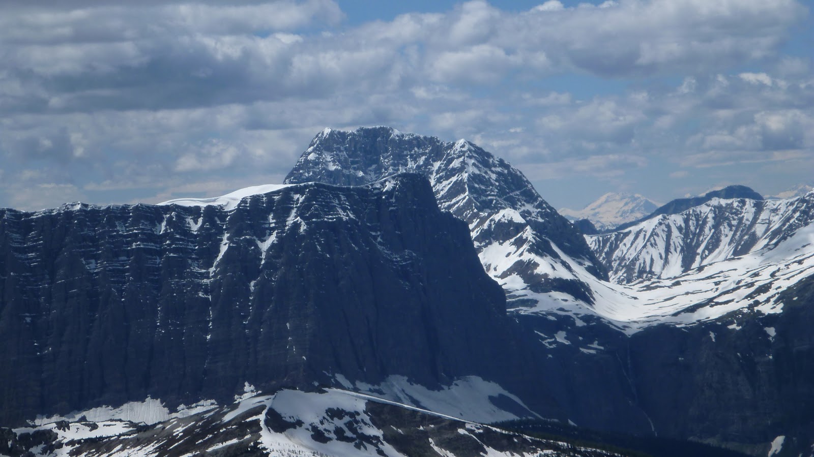
The massive Goodsir to the west

Not sure if the snowy peak in the centre is Mt Vaux

Zooming in on Mt Biddle in Yoho NP

A closer look at (l-r) Mount Hungabee, Neptuak Mountain, Deltaform Mountain(C), and Mt Allen to the NW

A close-up of (l-r) Mount Hungabee, Neptuak Mountain, and Deltaform Mountain

Sitting in front of the mighty Mt Temple(C,B), Tonsa Peak(L) and Mount Bowlen(R) are apparently two dwarfs

l-r: Tonsa Peak, Mt Temple, Mount Bowlen, Mt Little(C), and Mt Fay

Looking N-NE towards Mt Fay(CL), Quadra Mtn(CR), and Bident Mtn(rightmost) with Chimney Peak rising in front of Quadra

The unofficially named Chimper Peak to the right

l-r: Mt Biddle, Mount Hungabee, Neptuak Mountain, Deltaform Mountain(CR), and Mt Allen

Mt Deltaform in the Ten Peak Valley

Return the same way we came

Looking down the gully leading to Paint Pots Trail

Back on Paint Pots Trail

On the way out

Back to the parking

The end.
No comments:
Post a Comment